

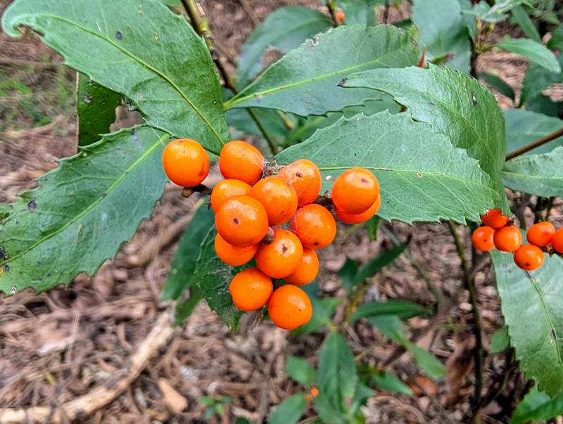
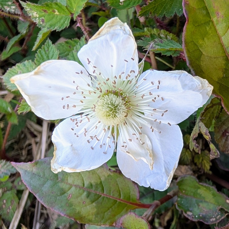
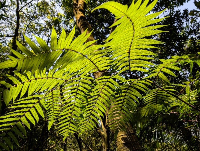
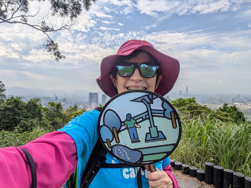
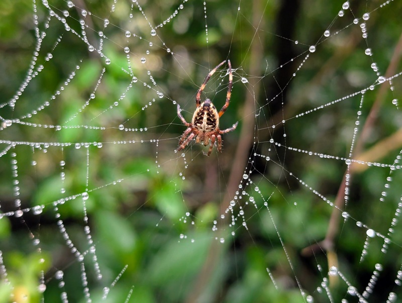
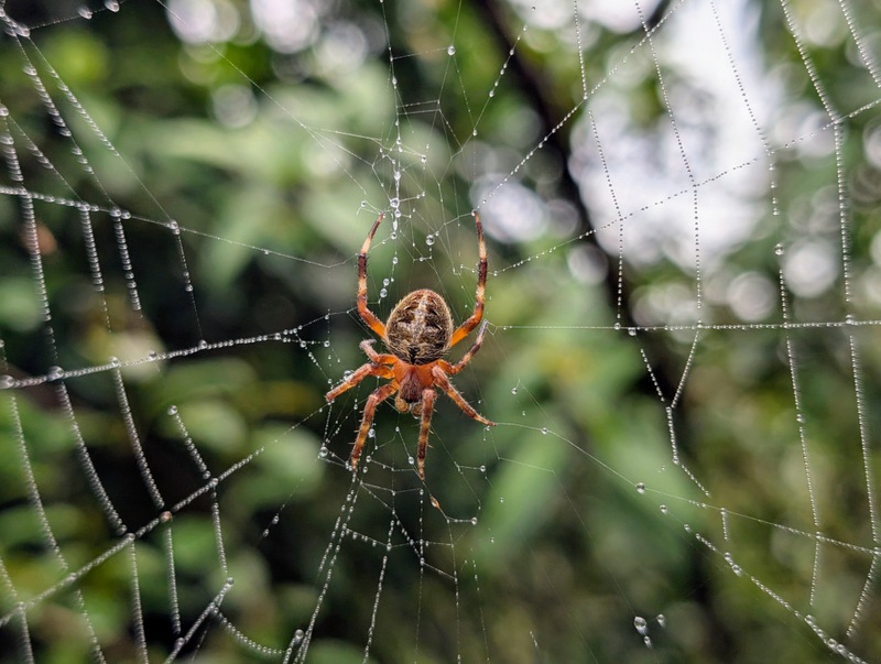
The Taipei Grand Trail (TGT) is a fun way to explore the mountains and hills that surround Taipei, on a series of well-trodden and clearly-marked footpaths that link up into one big 130 km-long trail. This includes 92 km of walking, divided into 7 sections, and a final section of 38 km cycling along the river to join the ends together in a big loop. Each section is a good half-day hike, mostly about 5 hours walking, and if you’re fit and healthy and like a challenge, of course, you can do one or more sections together; some people aim to do the whole thing in 24 hours! On a fine day, the scenery is beautiful and the views all over the Taipei basin are amazing. It is worth waiting for good weather, the photos will look much better, I can assure you! This is the 4th time I have done this trail (see my report of Taipei Grand Trail 2023 here), but I missed last year altogether, because having waited for cooler weather to come in autumn, we then had a series of terrible typhoons and non-stop rain that seemed to go on for months. Typhoon Kong-Rey was the worst, on October 31, 2024, resulting in major damage to many TGT footpaths with fallen trees and landslides. The path from Xiaoyoukeng up Mt. Qixing in Section 3 was closed for several months as a result, and the TGT was rerouted around the mountain. But normally, spring and autumn are the best times ~ summer is too hot and winter too wet, but you never know, weather and air quality are notoriously unpredictable!
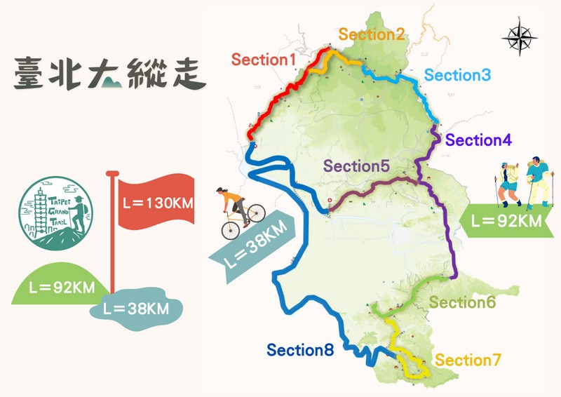
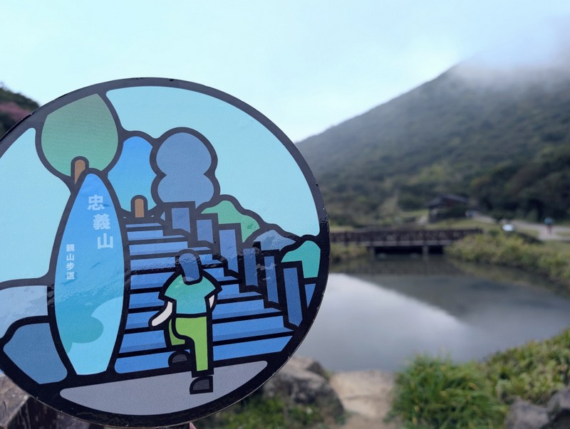
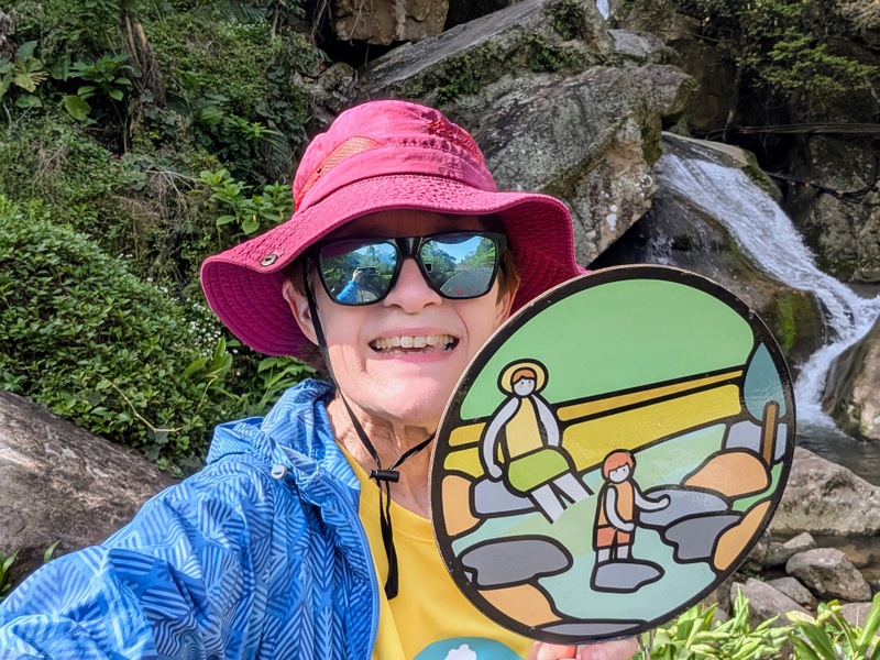
The Taipei Grand Trail is a project of the Taipei City Government, set up in 2018 by the Taipei City Geotechnical Engineering Office, Public Works Department (based at 3F. No. 300, Song-De Road, Taipei, not too far from Xiangshan MRT Station – you need to know this address to go and redeem your prize at the end). They use the Taiwan-run Hiking BIJI app, so having downloaded each section’s map via the app, you then follow the moving line on the route, and as you go, the phone pings as you collect ‘treasures’, 7 treasures for each section, each section with its own landmark logo, so 56 in total. The logos also appear on circular metal signs, 2 on each section, their locations marked on the BIJI map by flags. Once you get the hang of it, it’s not difficult, but you need to keep track of those ‘pinging treasures’ because the signal is often weak, and if you miss a ‘treasure’, you then have to retrace your steps to pick it up! This happened to me at least once on nearly every section, so watch out! When all 56 treasures have been collected, go and collect your certificate and gifts from the Geotechnical Engineering Office. If you don’t have the app, you can still do the trail and take selfie photos with those metal logos as you go, 2 for each section, and submit the photos to show you’ve completed it all. This year’s Taipei Grand Trail officially started on February 27, 2025, and lasts throughout the year, with a chance to do it all for a second time, starting from May 29. The ‘Redemption Period’ (gotta love that phrase!) is from June 2 onwards.

Section 1:關渡站至二子坪 Guandu MRT Station to Erziping in Yangmingshan 陽明山 National Park: Monday, March 3, 11.7 km
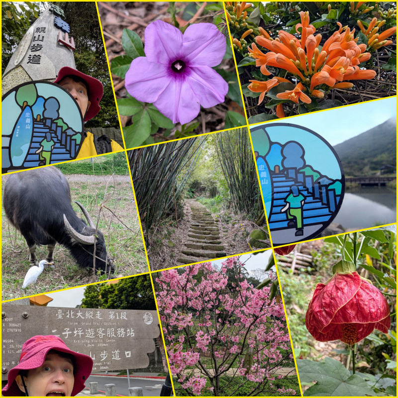
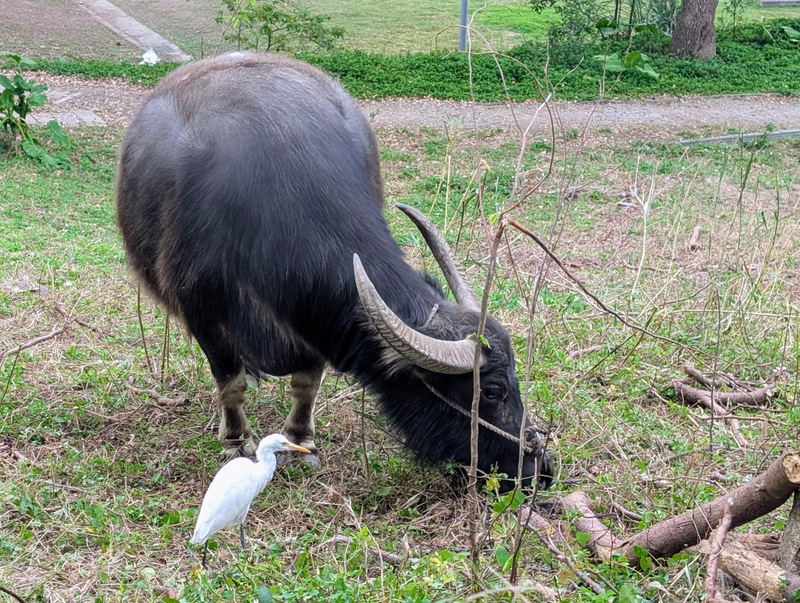
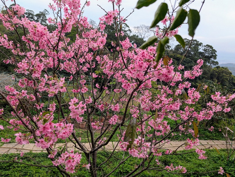
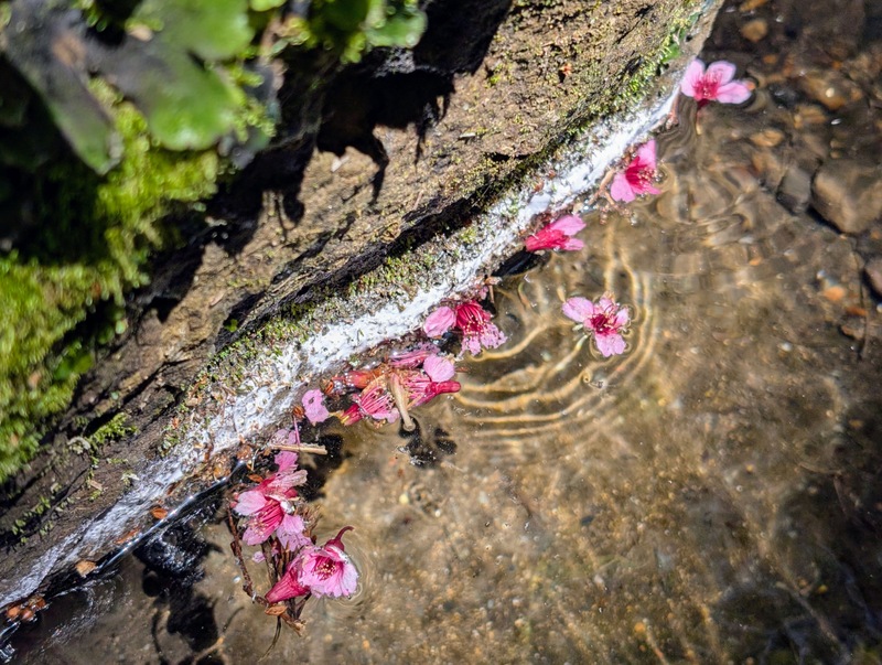
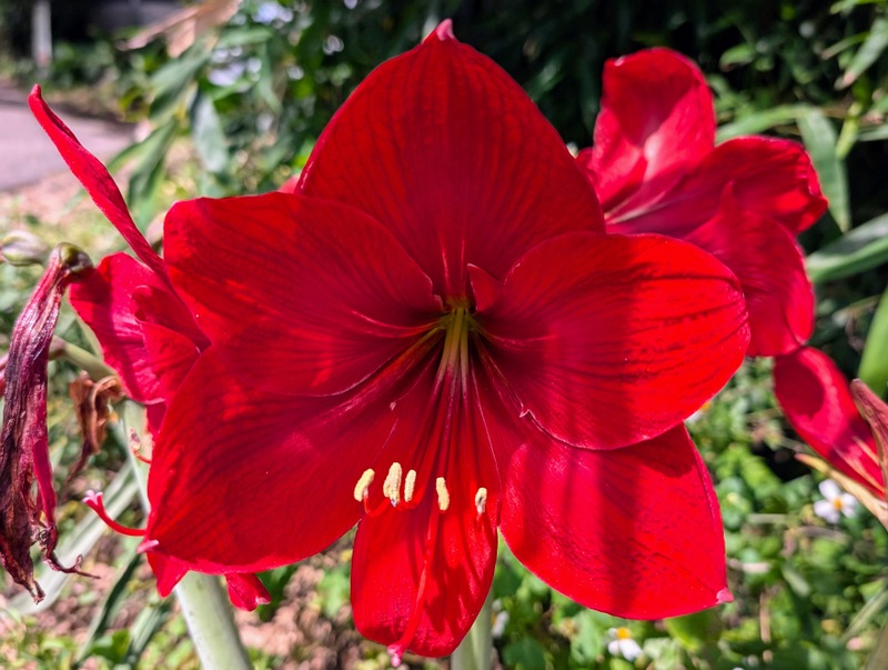
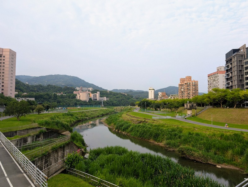
The official start of the Taipei Grand Trail is a signpost just outside the back of Guandu MRT Station, from where Section 1 heads up the side of the Yangmingshan Mountains, 966m elevation gain to Erziping. Spring is a good time to see the cherry blossom, though a fine, sunny day is not guaranteed; the day I chose was dry but overcast, and foggy higher up. The route goes up by Guandu Elementary School and through the Taipei National University of the Arts campus, where there are a few water buffalo and accompanying egrets to spot. Some of the route is along a main road, used as a shortcut by people driving into Taipei, so beware of traffic, especially on a weekday. Higher up, out of the city, the route goes by new housing developments overlooking the coast, golf clubs, houses, farms and gardens, and up to Qingtian Temple, a small village with toilets and a water fountain, but no shop. It’s also the bus terminus for the S6, which goes up and down to Beitou MRT Station every 30 minutes or so throughout the day. From Qingtian Temple, the route is straight up the main mountain path to Erziping. You can, of course, do this section in downhill mode instead, starting at Erziping. Ideally, one day, the Taipei City and New Taipei City Governments might come together to make a trail that takes in both Taipei City and New Taipei City areas, and that would mean including Mt. Miantian and Mt. Xiangtian, which are part of the Yangmingshan ridge but outside the area of Taipei City – they could be included in this section, and give Section 1 an added boost, that of walking up from sea level to the first major peak on the ridge.


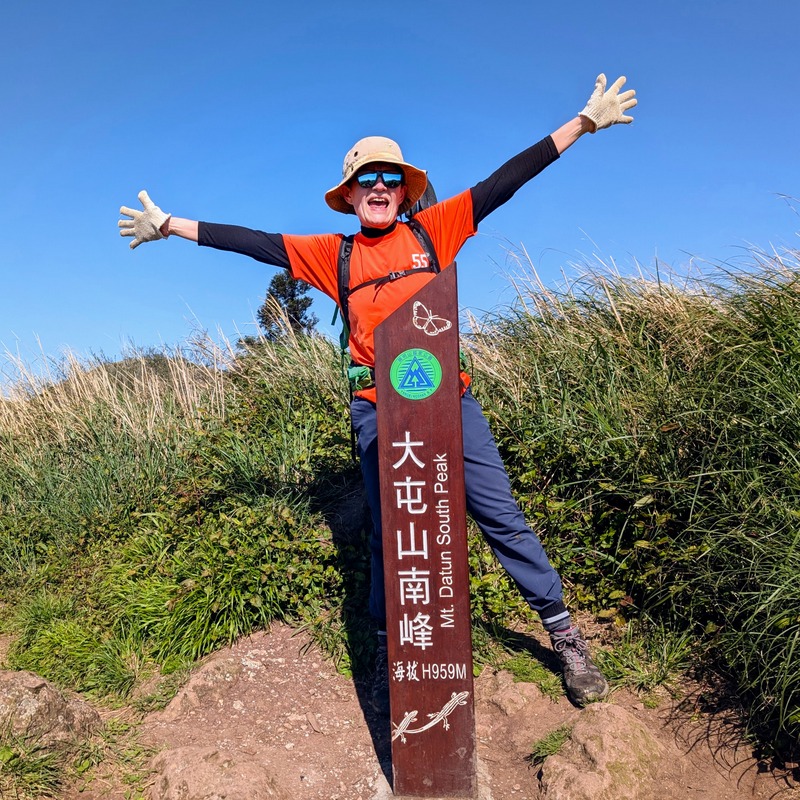
Section 2:二子坪至小油坑 Erziping to Xiaoyoukeng via Datun West, South & Main Peaks 大屯山 & Zhuzihu 竹子湖: Saturday, March 22, 9.3 km

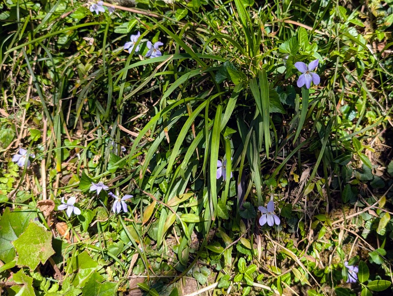
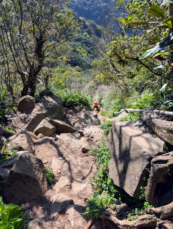
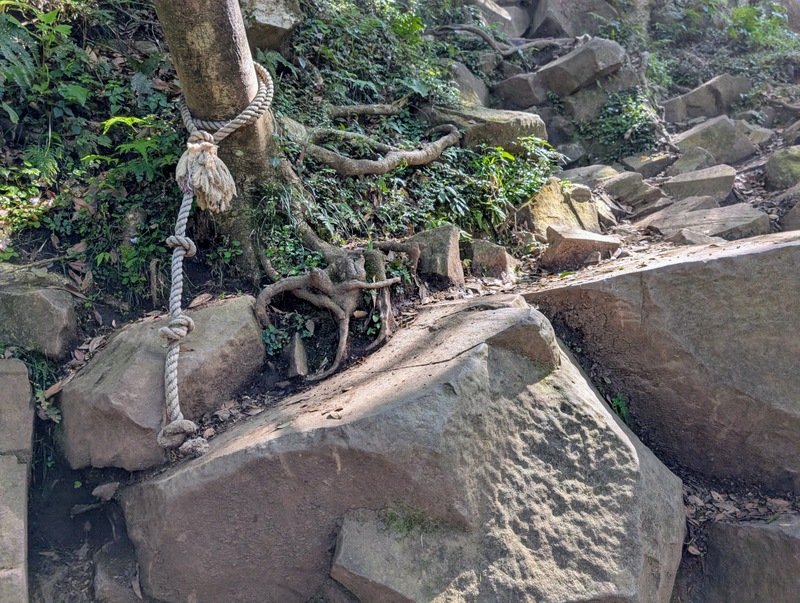
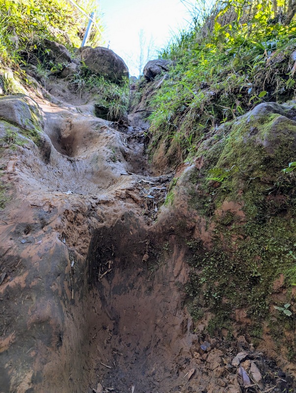
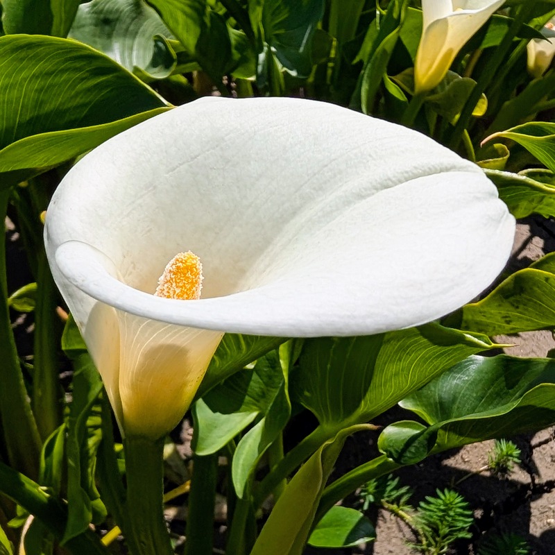
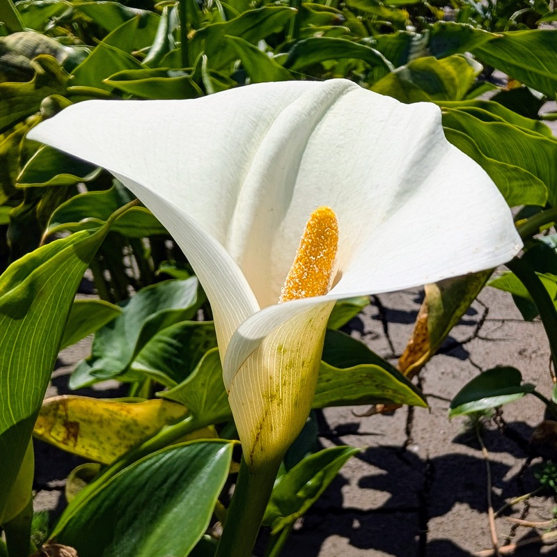
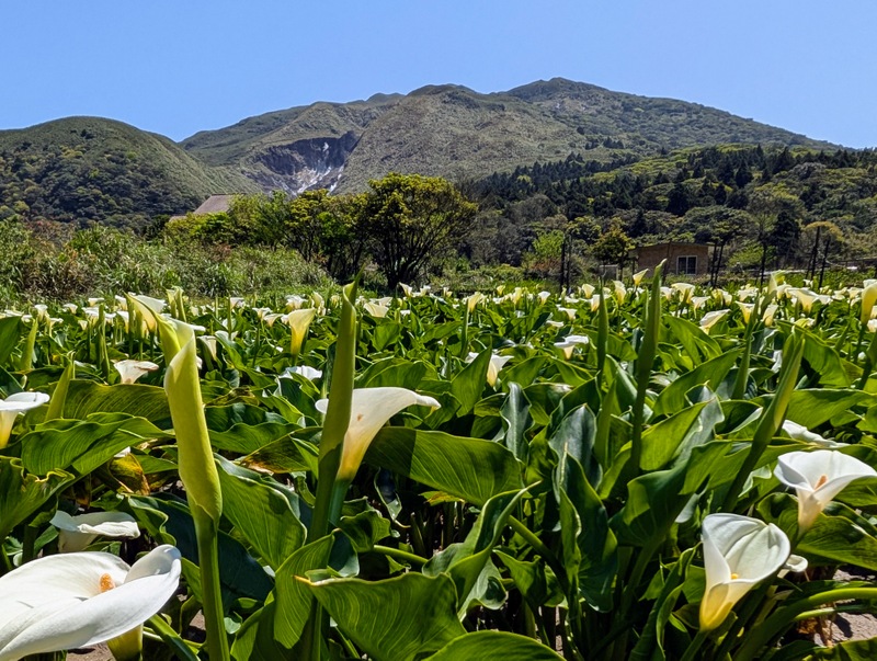
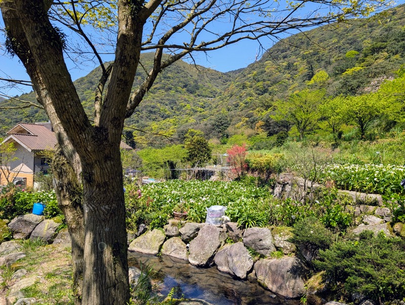
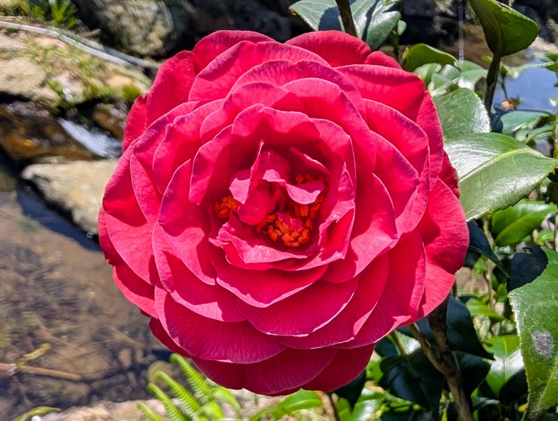
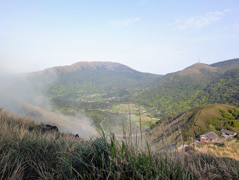
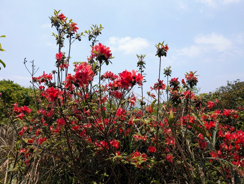
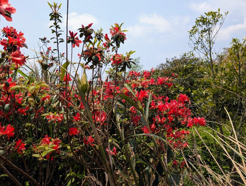
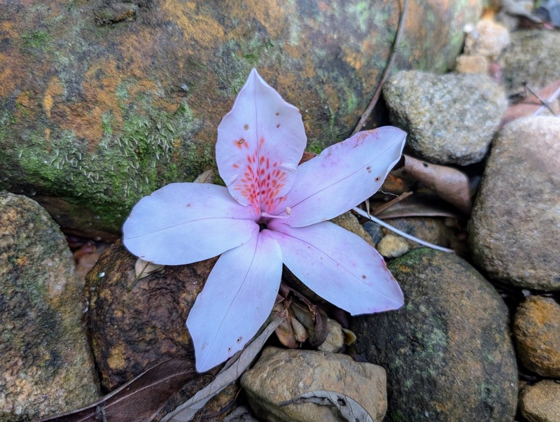
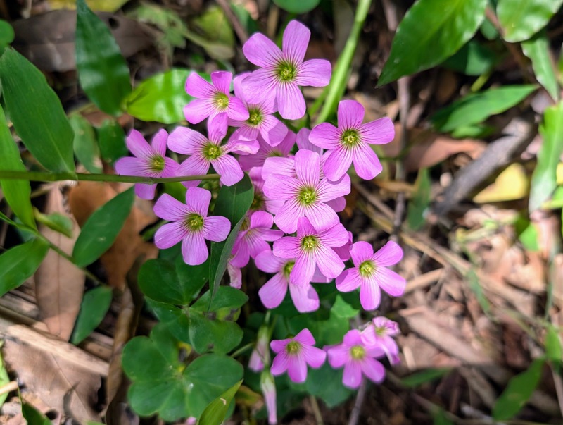
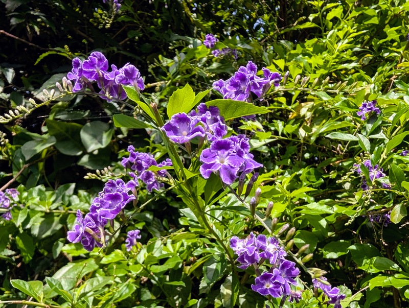
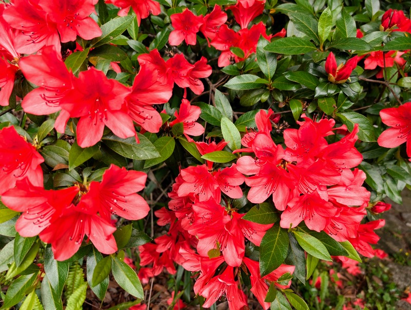
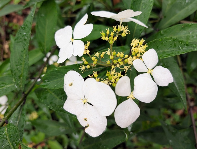
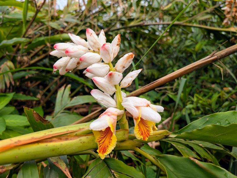
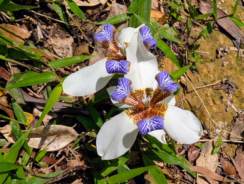
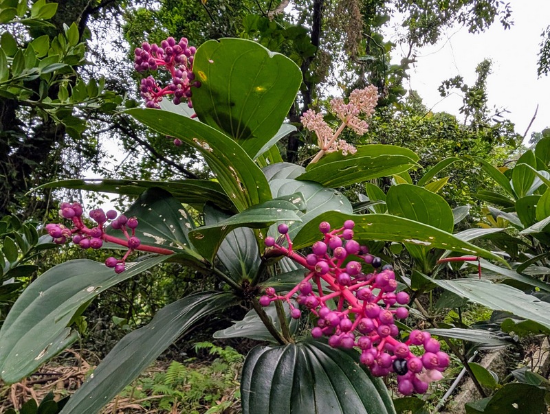
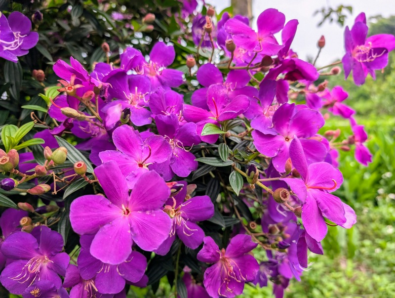
What weather, what a day! Yes, it was hot, but nowhere near as hot as it would be in summer, and it was also dry; this is important for all those steep roped parts of the trail, which otherwise would be a slippery sea of mud! Take some old gloves to help you haul yourself up and down. With such good weather, it was also very crowded, a lot of people were doing this section of the TGT that day, so on a sunny day, get there early! The trail officially starts at the Erziping Visitor Centre, and starts going seriously uphill at the Miantianping Pavilion. The route goes up to Datun West Peak (982m), Datun South Peak (957m), and then up to Datun Main Peak (1092m). From there, we could even see late winter snow on the top of the far distant mountains in Taiwan’s central range, Nanhu and Xueshan. Incredible! Once down to Anbu, the route goes along and further on down to Zhuzihu, famous for its calla lilies and hydrangeas – the calla lilies were in stunning full bloom, and so were the azaleas. The route ends up at Xiaoyoukeng, famous for its fumaroles and volcanic smoke, and the terrible smell!


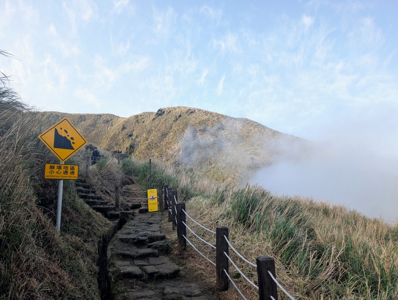
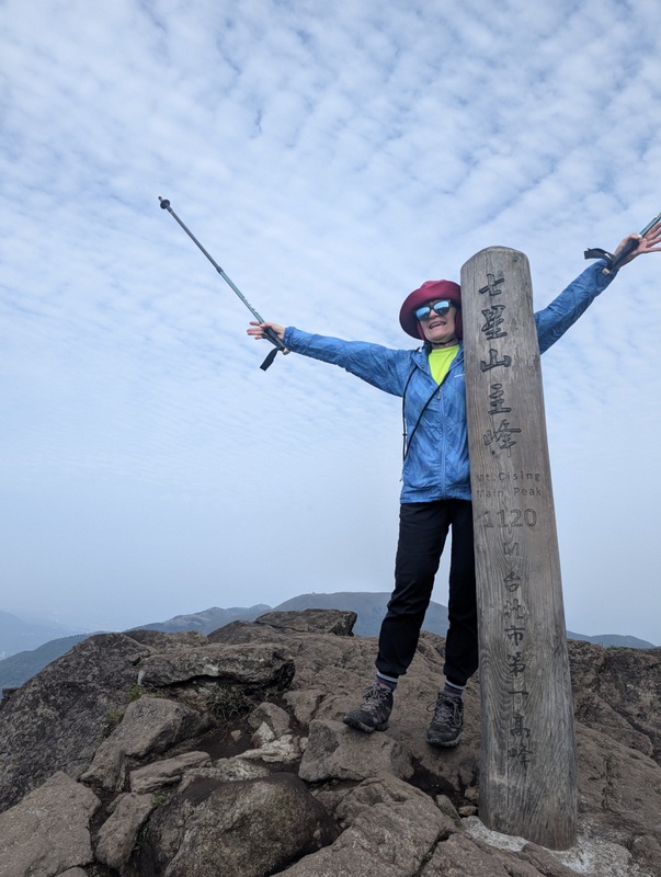
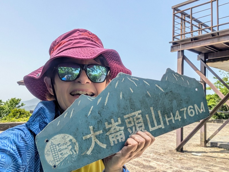
Section 3:小油坑至風櫃口 Xiaoyoukeng to Fengguikou via Qixingshan 七星山: Friday, April 4 (Tomb-Sweeping Festival weekend), 10.4 km

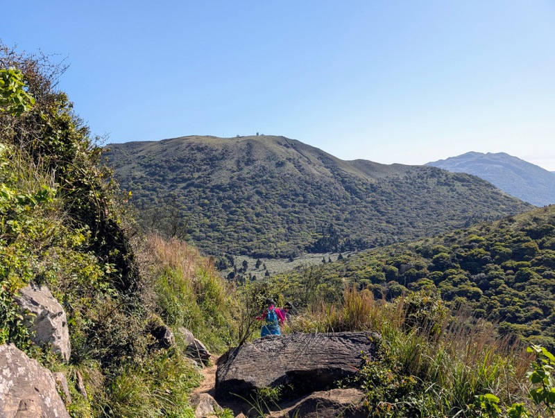
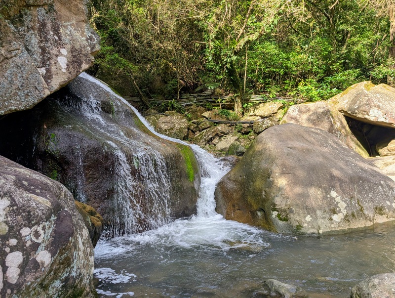
A hazy but fine day over our 4-day Tomb-Sweeping Weekend, and very crowded with lots of people on the Yangmingshan ridge. This is a long walk, and it’s a short steep climb up to the top of Mt. Qixing, 1,120 m – the highest peak on the TGT, also the highest peak in Yangmingshan, Taipei City and the highest dormant volcano in Taiwan – though when you see all that belching smoke coming out at Xiaoyokeng, it doesn’t seem as dormant as perhaps we are led to believe! This part of the trail was closed for several months after Typhoon Kong-Rey, and only a few weeks ago was the site of a wildfire that burned for several hours. It’s most unusual to have a wildfire up there, given all the rain. Anyway, the path is now fully open once more. The route then winds down to Lengshuikeng, past all the sleeping water buffalo (with curved horns) and Taijima cattle (straight horns), and onwards to Fengguikou, where the challenge is to arrive in time for the M1 bus that gets to Fengguizui just before 2:00 pm, otherwise, you have to wait another 2 hours, or walk down further to Shengren Waterfall. It’s always a wonderful high-level walk, and I love it!


Section 4:風櫃口至大湖公園站 Fengguikou down to Dahu Park MRT: Monday, April 14, 11.1 km

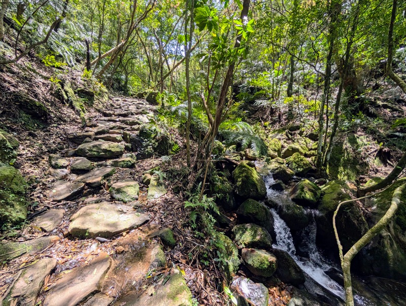
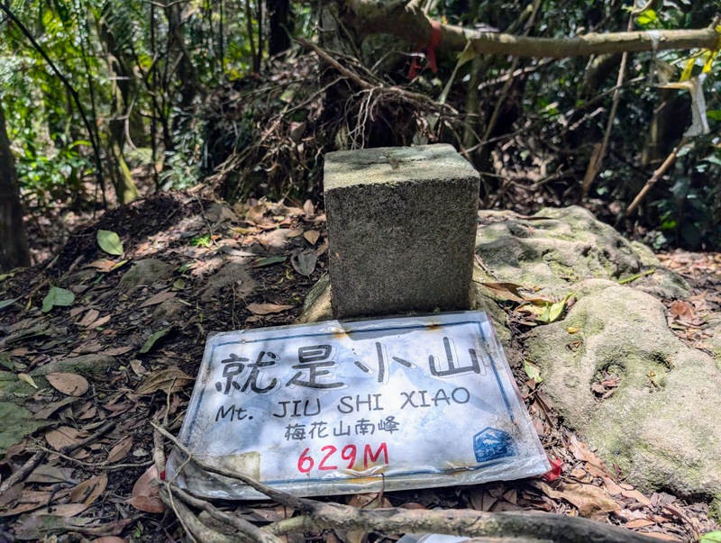
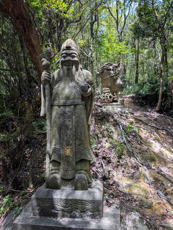
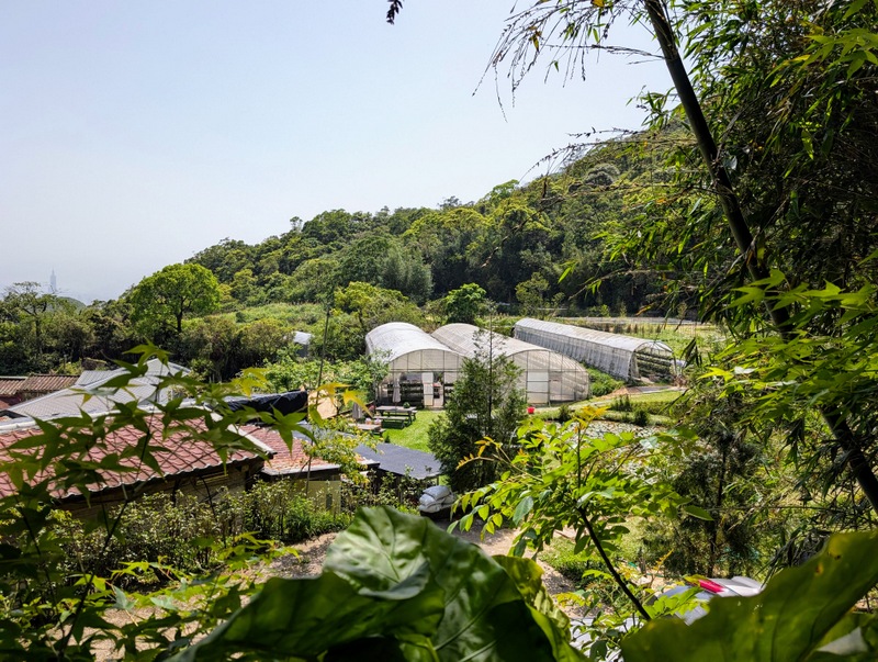
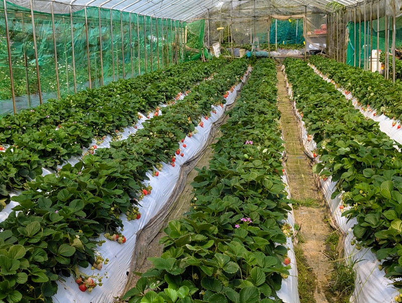
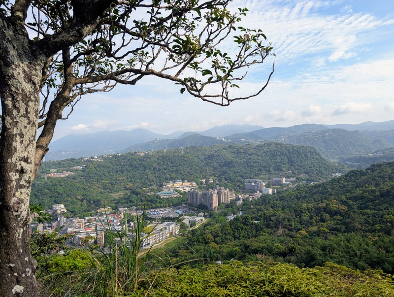
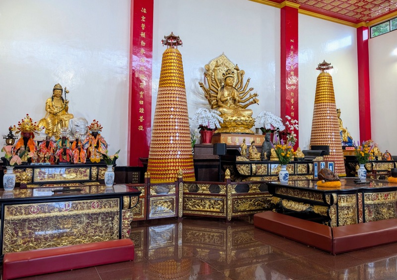
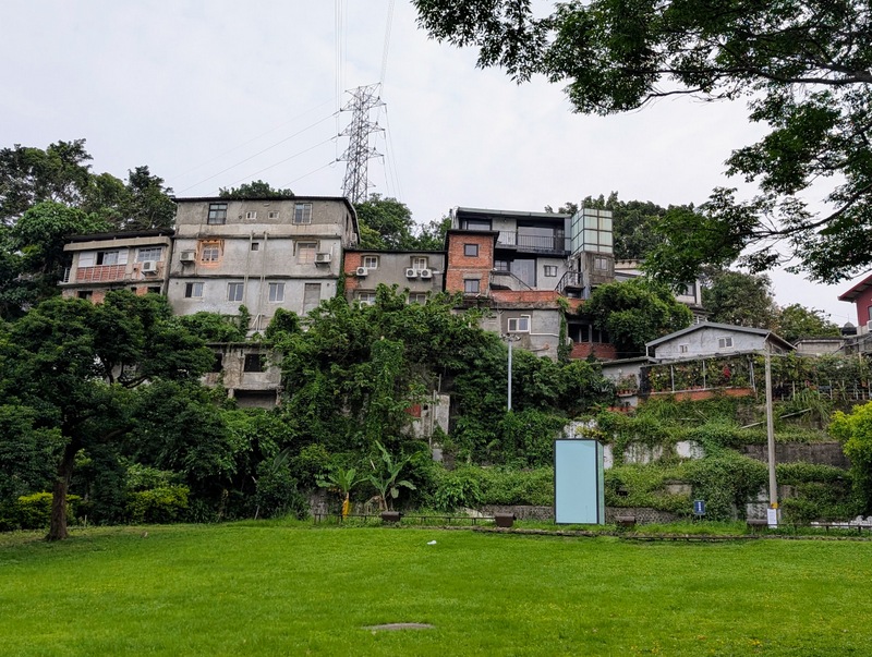
Section 4 of the TGT is the section that has been most improved over the last few years, and with the trail getting much more popular, it feels far less isolated than in the past – as you’ll see below, those temple statues just sort of appear out of the dark forest, or maybe it’s just that I now know what to expect! This is the only section where all the ‘pings’ went off as they should, and I didn’t need to retrace my steps! It is a beautiful walk, mostly downhill through forests and along streams, so it is cool and refreshing, though that means there are few views, and mostly hazy. The first part is uphill to Mt. Meihua (642m), and then it’s downhill from there, all the way to Neihu, where there are lots of greenhouses full of strawberries, temples, shrines, waterfalls, and all sorts of interesting things. It’s a part of Taipei that I don’t visit very much, but it is very popular with visitors, especially at weekends.

The walk starts from Fenguikou, and the M1 bus goes there from outside Jiantan MRT Station, right opposite the new performing arts centre – that’s the building below with that big carbuncle. The main problem with the M1 bus is that the first bus, at 6:10 am is too early, I can’t get there in time (Taipei MRT starts at 6:00 am and it takes 20 minutes for me to get to Jiantan), and although there is another bus at 6:30 am, it’s only at weekends, and it is usually packed out if it’s a sunny day. So, as I went on a Monday, I had to wait until the next bus at 10:10, which arrives at Fenguizui at almost 11:00 am, so it is a late start. That’s why so many people walk Sections 3 and 4 together, on the same day, one following the other, also, I guess, because Section 4 is mostly downhill. I did that last time, and it’s possible to do – just a bit tired by the end!


Section 5:劍潭支線 Jiantan Trail: Jiantan MRT Station to Dahu Park MRT Station: Saturday, April 19 (Easter Eve), 10.5 km
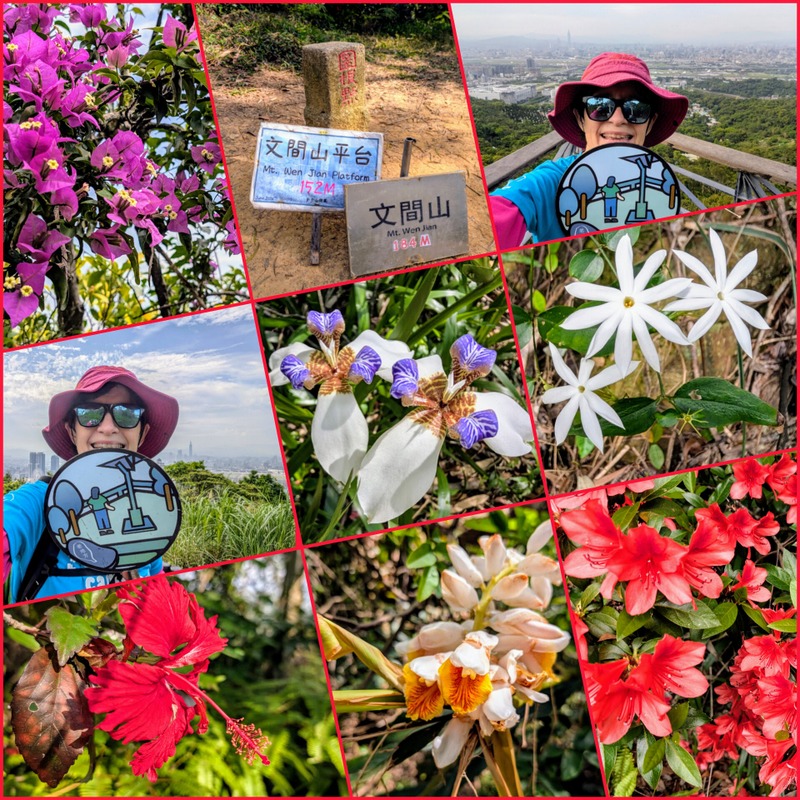
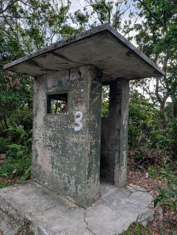
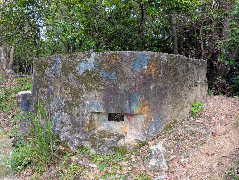
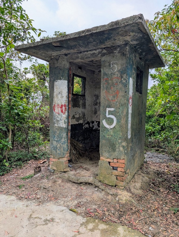
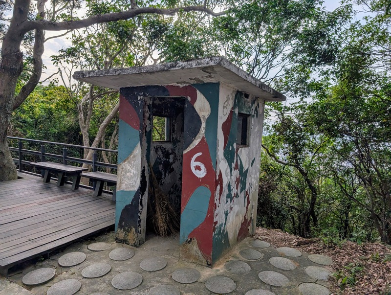
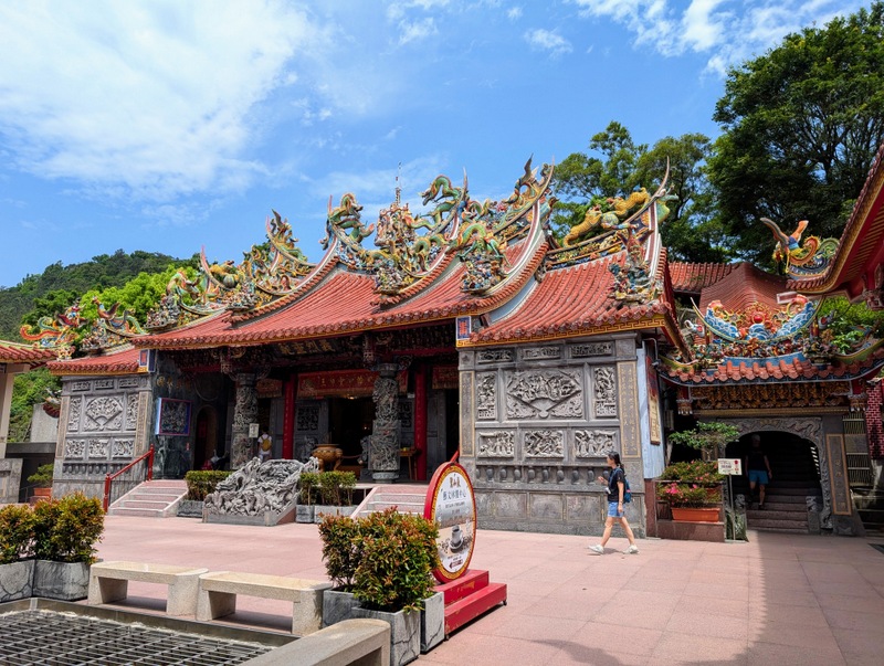
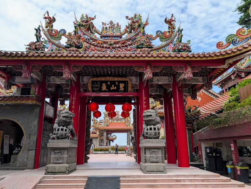
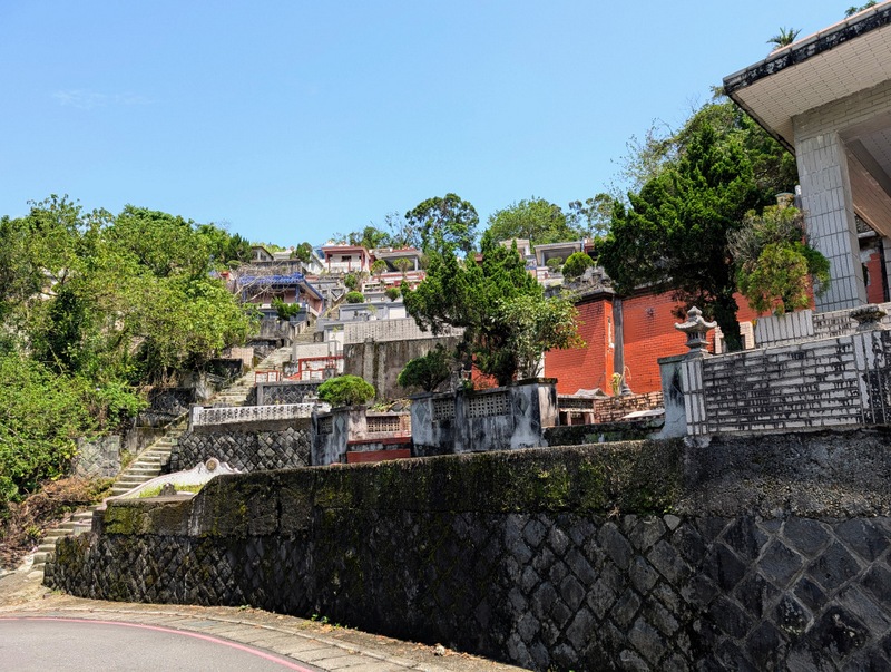
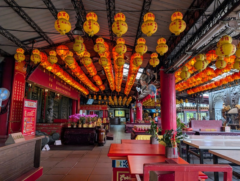
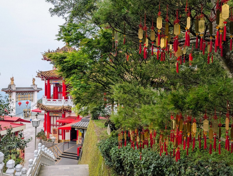
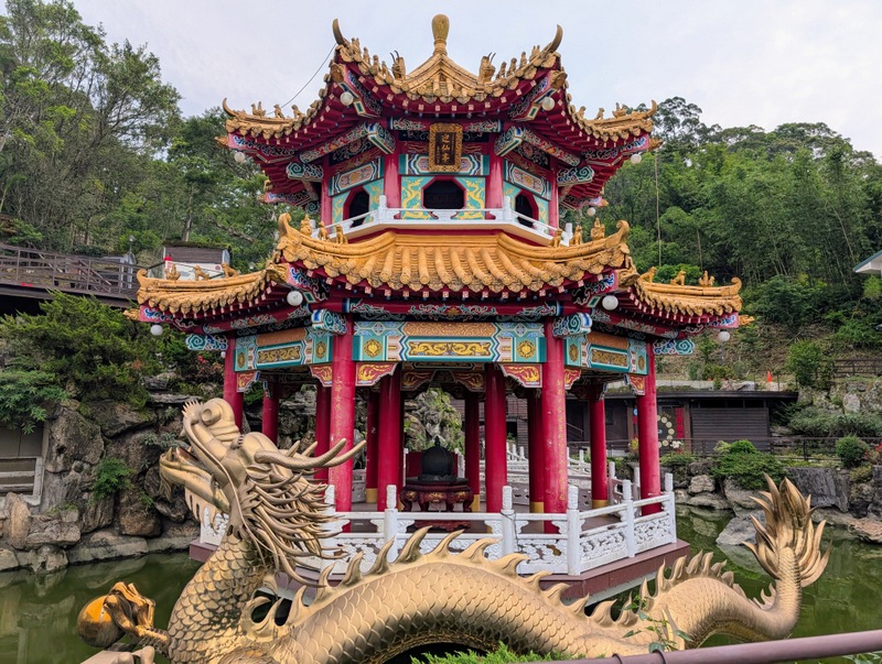
The TGT is shaped a bit like the number ‘8’, and the middle bit, crossing Taipei City from west to east, is Section 5. This is possibly the easiest and most popular section of the whole trail. There are always lots of people; it’s near residential communities and very easy for local people to get up here for a few hours of exercise. The trail starts by the side of the Grand Hotel, and in the past, much of the area was closed off for military use, and some areas are still out of bounds. Check out the many abandoned sentry boxes and guard posts. It’s also very popular with people wanting to watch the planes taking off from Songshan Airport, and has good views of the National Palace Museum in the other direction. The highest point is Mt. Wenjian (152m or 184m, depending on which of the 2 signs is correct!) Further along, eastwards, are temples, graveyards (including a Christian graveyard, with many crosses), a mountain with a Chiang Kai-Shek statue on the top, and all sorts of other interesting things. Bishan Temple always has lots of people; it also has toilets, a water machine, and even a place selling coffee (by donation). The temple is officially the end of Section 5, but it’s nice to walk on down to the Yuan-Jue Waterfall for paddling, and so down to Dahu Park MRT Station, the same ending as Section 4.


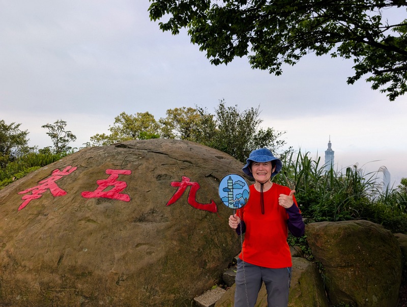
Section 6: Bus from Dahu Park MRT Station 大湖公園站 to China University of Science and Technology (CUST) 中華科大 to start Section 6: 中華科大至麟光站 CUST, Nangang to Linguang MRT Station via 95 Peak: Monday, April 21 (Easter Monday), 10.1 km

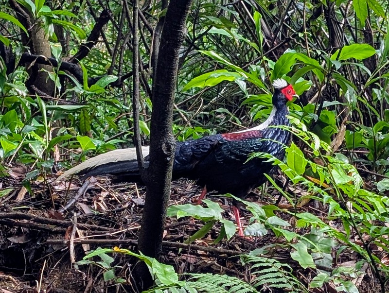
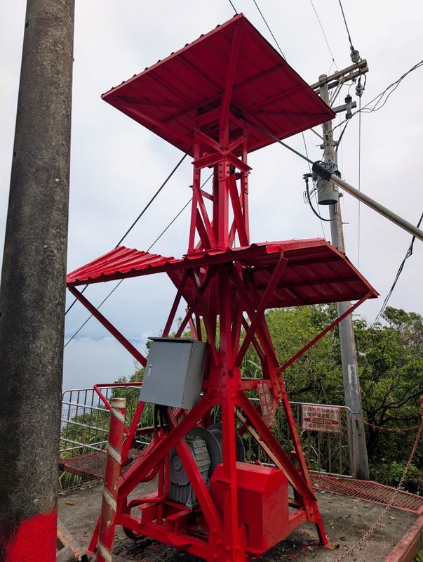
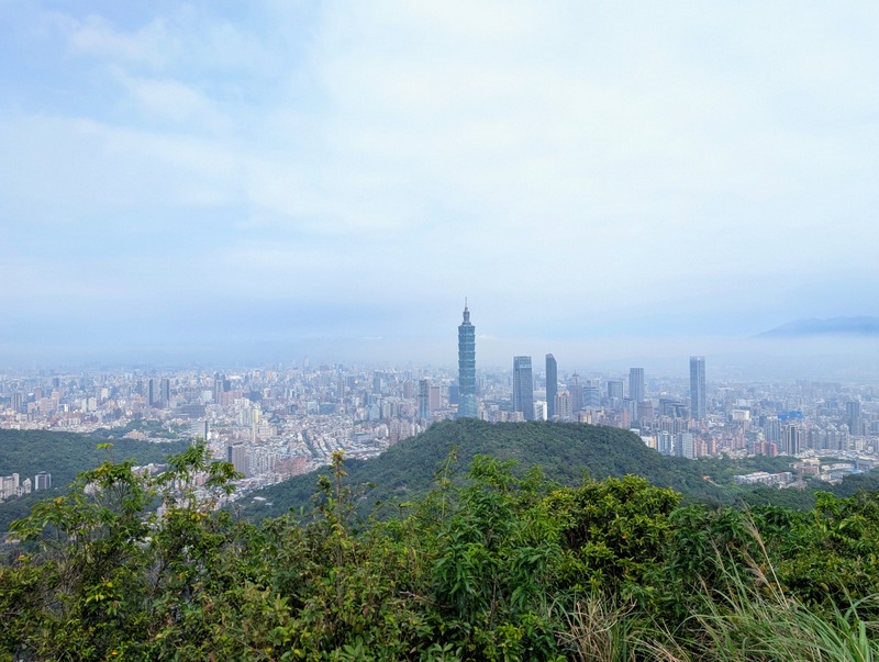
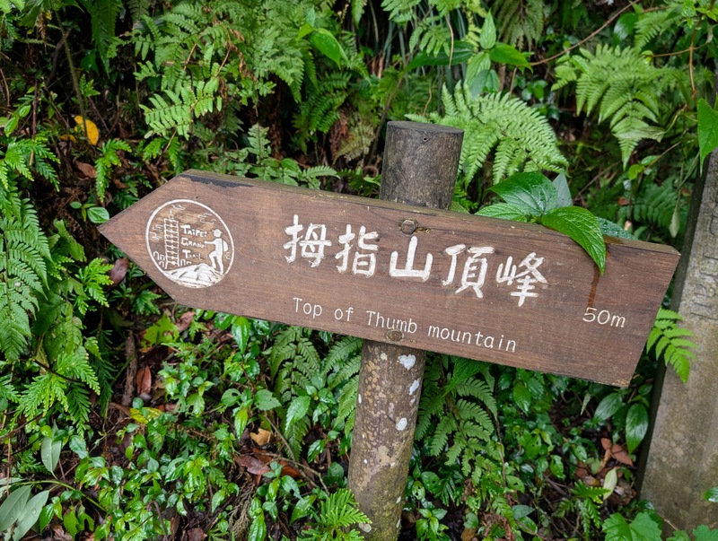
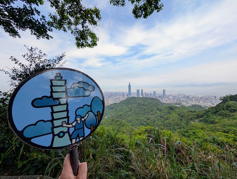
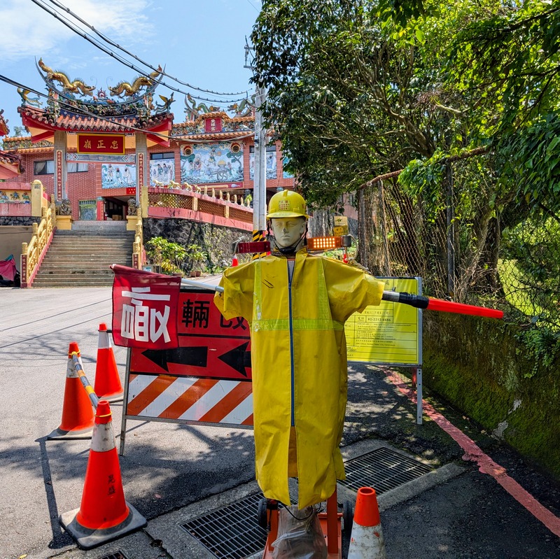
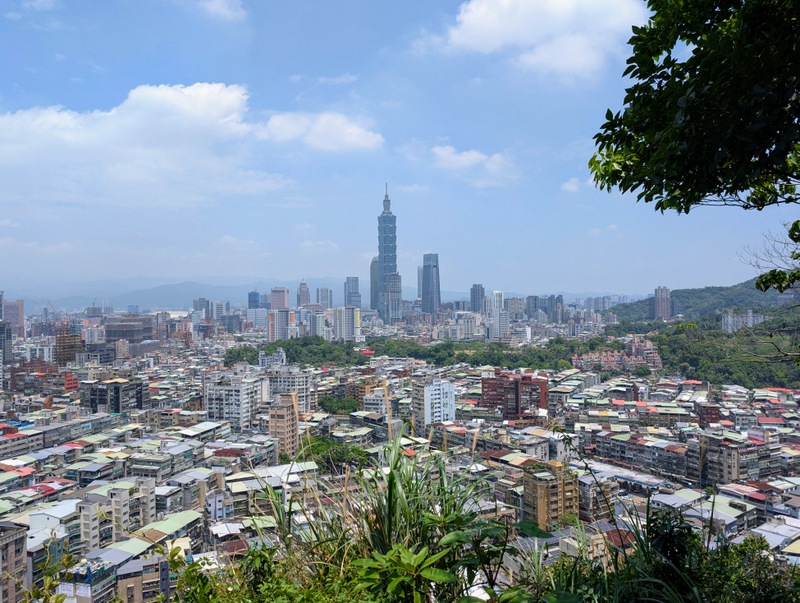
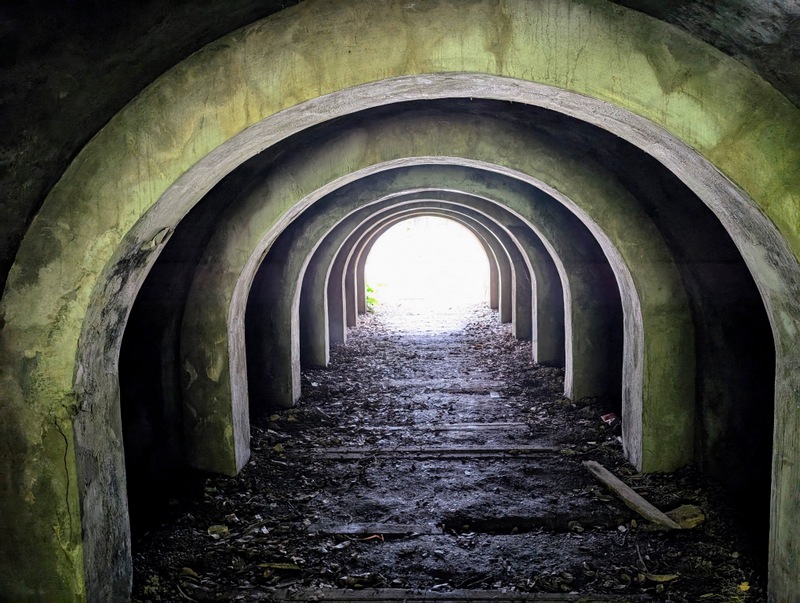
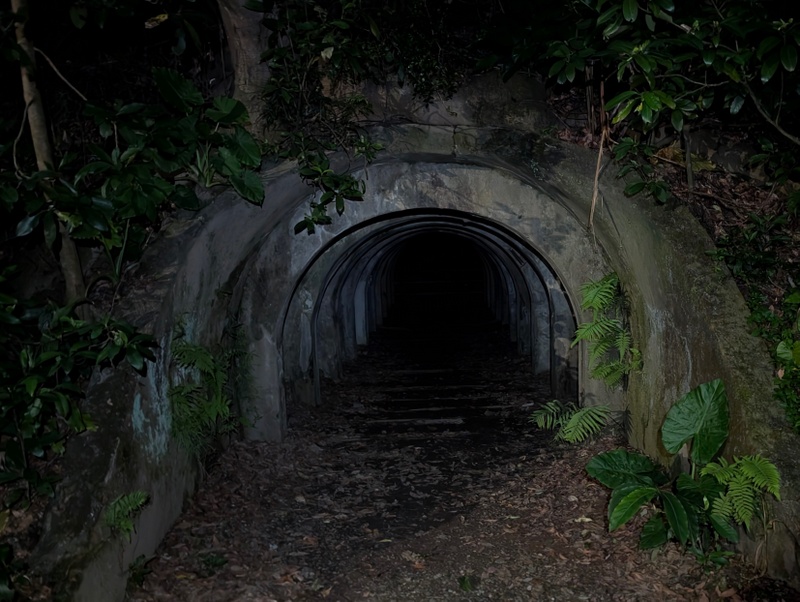
This day started off with a lot of low cloud over Taipei City, which fortunately lifted as the morning went on, so the views improved as the hours went by. To complete the TGT without any gaps, there is one section, from Dahu MRT Station to China University of Science and Technology (CUST), that is 8 km, all urban, along main roads, and involves crossing the main river, so although it is possible to walk or cycle, it would be horrible. Hence the bus! This is the only section that really involves a bus rather than walking or cycling, but it’s worth it. There is a Bei-Huan (North Circular) Bus from Dahu MRT to CUST, so it’s a good way to connect Sections 4, 5 and 6. Section 6 starts with a long climb of about 90 minutes to Mt. Nangang (374m), where the red pulley station is located, also the 95 Peak 九五峰 (375m), and Mt. Thumb. It was on this section that I saw my first ever Swinhoe’s Pheasant (Taiwan Blue Pheasant 藍腹鷴), one of Taiwan’s endemic birds – it’s big and very beautiful, and it spent a long time looking at us! From there it’s mostly down, but with lots of steep ups and downs for the rest of the route, which winds its way through a few isolated residential high-rise estates (one of them has a new water fountain, wonderful on such a hot day), graveyards, bamboo groves, shrines and temples (one with a ‘moving workman’ statue at the roadworks in front of the temple – the workman continuously waves his arms up and down!), all with views of Taipei 101, which is the picture on the ‘pinging treasure’ as well as the main logo for the day. The endpoint is an ecological park full of old military tunnels, near Linguang MRT Station, which conveniently happens to be only 2 stops on the Brown Line from where I live, so I was back here in no time. But being a low-level walk, it was extremely hot and humid – that new water fountain was a godsend!


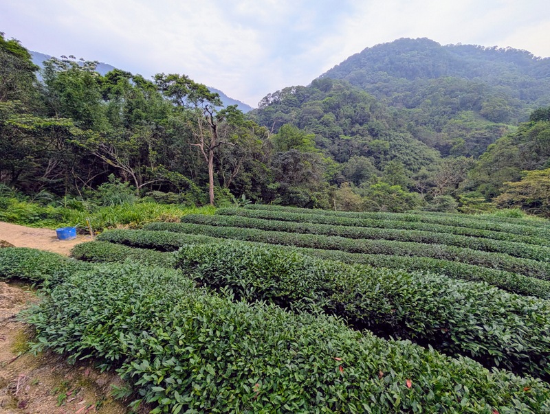
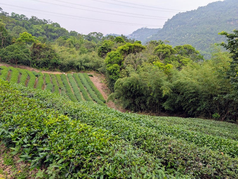
Section 7:麟光站至捷運動物園站 Linguang MRT Station to Taipei Zoo MRT Station via Maokong 貓空 Tea Plantations: Thursday, May 1 (Labour Day holiday), 17.1 km (Google records it as 22.2 km)

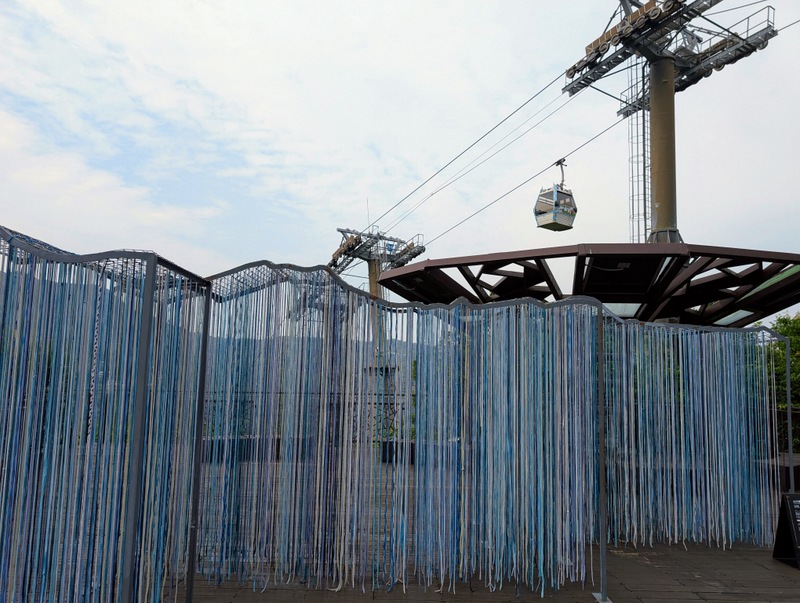
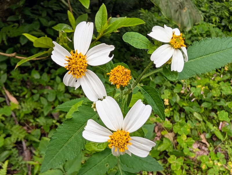
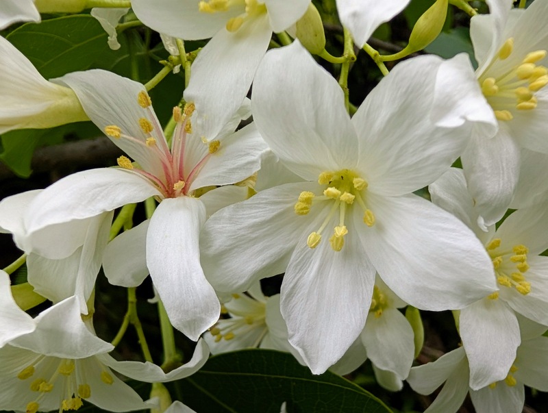
This section of the Taipei Grand Trail is completely different from all the others, starting off climbing up the hills to escape Taipei by retracing the final section of Section 6, then down through the very busy suburb of Muzha, filled with markets, shops and schools, and then up to Maokong by the Zhinan Temple Trail, where visitors galore come up by cable car to enjoy the views, tea and restaurants. Thursday, May 1 was Labour Day holiday, which means schools and universities were still in session, but not kindergartens, and Maokong was full of people enjoying a day out, including a lot of tourists – the lines for the cable car were very long! It was hazy, dull, hot, and humid all day, so I started very early, just before dawn, and was finished by about 12:30 pm, which was 7 hours of walking, so this is the longest section by far. The ‘pinging treasures’ start only at the Zhinan Temple Trail, which means you have the option of a shorter route by starting at National ChengChi University. I did the whole route from Linguang MRT to connect with Section 6, which adds an extra 2 hours at the beginning. This year, the route through Muzha is slightly different, now passing McDonald’s and MosBurger – so the options for breakfast are huge! This is the only TGT section where there are lots of shops, including 7-Eleven and Family Mart Convenience Stores, plus toilets, and all sorts of other facilities available, like the temple up at Makong is now selling ice-cream! It’s a fascinating route, passing through such a variety of beautiful scenery, with the white tung blossom fully out, there were also people picking the tea leaves, and others cultivating their gardens. The temps were 28°C, ‘feels like’ 30°C. It was hot, hot, hot!


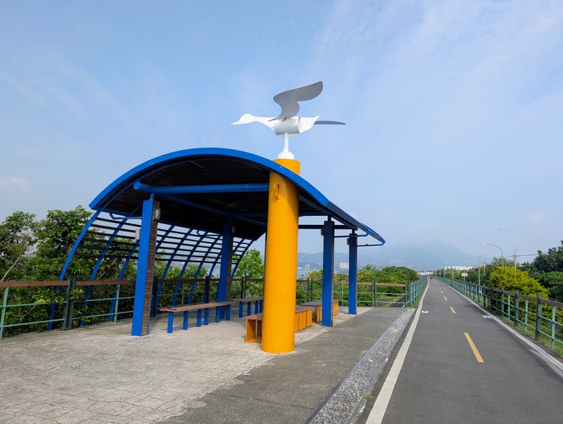
Section 8: 捷運動物園站至捷運關渡站 Taipei Zoo MRT Station to Guandu MRT Station by bicycle along the Taipei Riverside Bike Path: Saturday, May 3, 48 km (or 58 km)

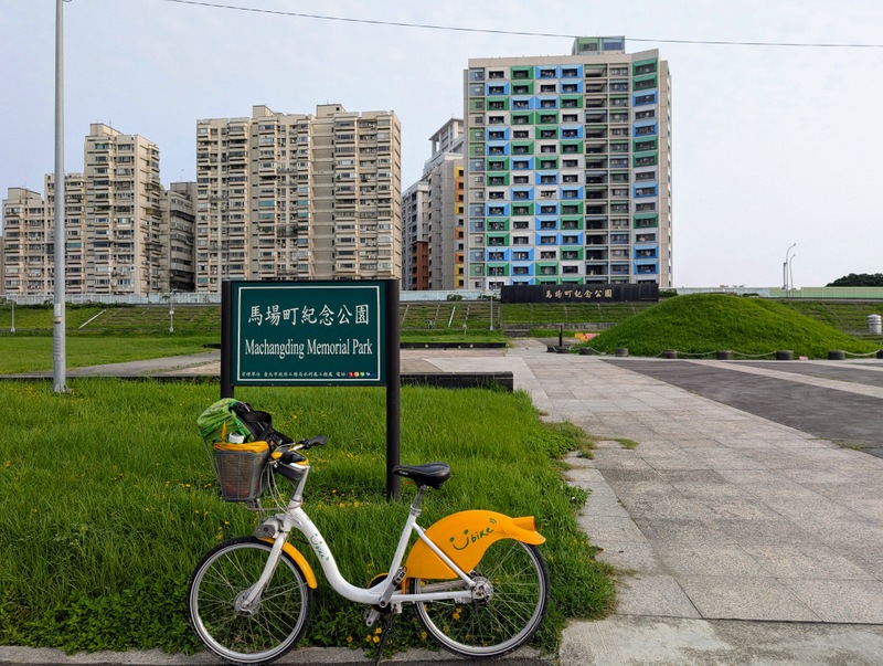
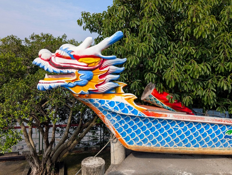
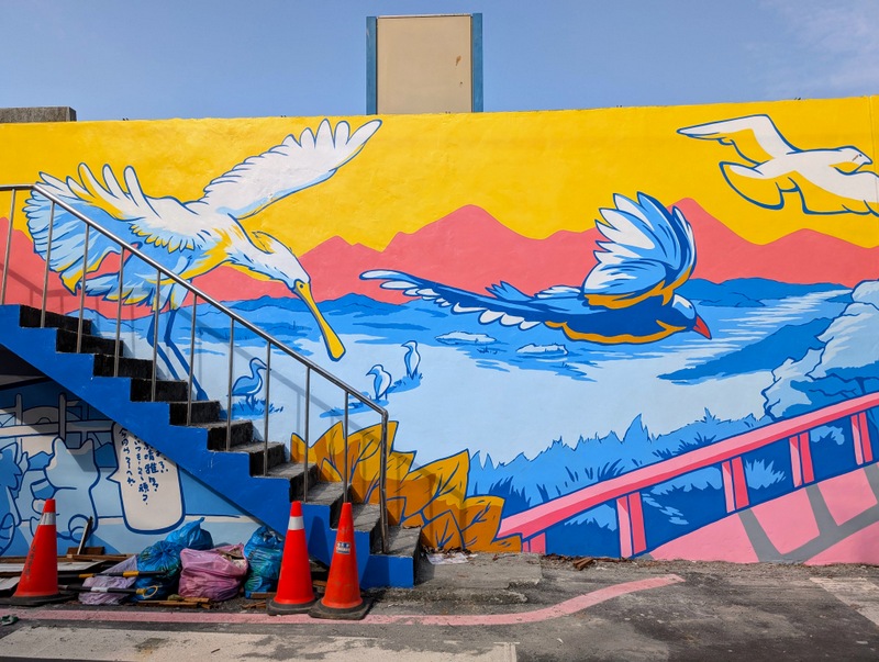
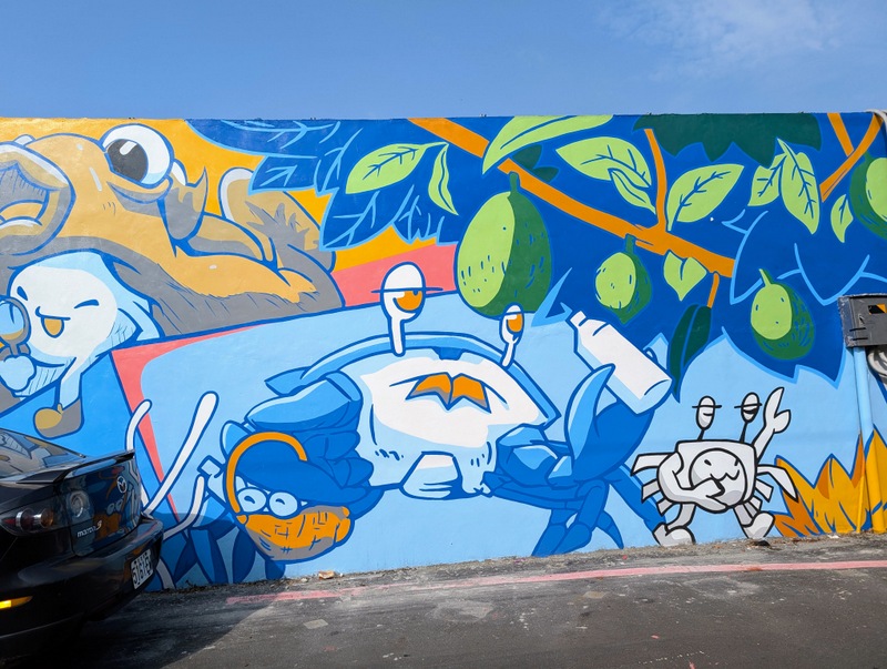
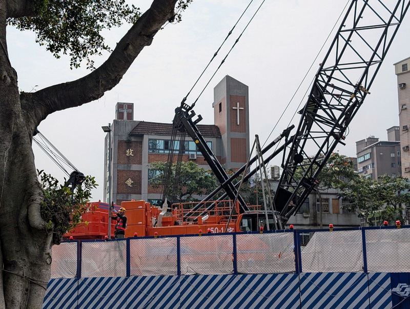
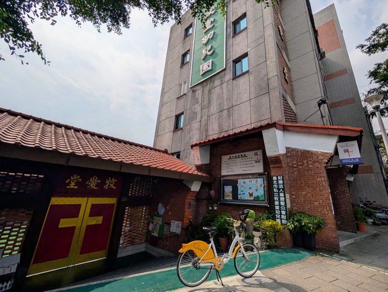
This was a hot and sultry morning as I set off by U-Bike from where I live in Taipei to get to Taipei Zoo MRT Station. It was still dark when I started at 4:40 am, but a bit cooler. An hour later, I arrived at the station, turned around and started the official route to Guandu. There are always a lot of walkers and cyclists out early in the morning on the riverside paths, especially on a weekend, so be warned. Also, there’s no shade, so go prepared! The route goes past Machangding, which has a sordid history as an execution ground during the martial law era, and is now a memorial park, then onwards to Dadaocheng, the old port and trading centre of Taipei. The Dragon-Boat Festival is coming, so dragon boats are much in evidence along the river. It is also the Mazu (Matsu) Festival season and in Shezidao, a huge parade of the deities was taking place, with firecrackers and banging of gongs, so I went down to take some photos. Also in Shezidao, a new wall mural is under construction, and the colours are brilliant. Once over the Shezi Bridge, I side-tracked and followed the optional route to Jiantian MRT Station to connect the full route to Section 5. The route to Jiantan MRT involved riding right past Good Shepherd Church, now surrounded by new MRT construction, so I rang the bell, and the rector, Rev. Keith C. C. Lee came out to take a photo! At Jiantan Station, about 100 people were waiting in lines for buses to Yangmingshan. I turned around and headed back to the river to continue on to Guandu, and reached the official end of the trail at about 11:00 am. The standard trail length of Section 8 is 38 km. I added an hour at the beginning and then another hour detour to get to Jiantan Station, so Hiking BIJI put my total distance that day at 48 km, while Google Fit recorded it as 58 km, which is quite a difference. Ah, well, whatever!


That’s the Taipei Grand Trail 2025 completed for this year, just in time for the Plum Rainy Season, which started this past week. As I type this, on Saturday, May 10, we’re in the middle of a major rainstorm, and listening to all that growling thunder makes me grateful I completed it all in time; this time last Saturday, I was cycling to Guandu in the sunshine to complete Section 8! #TGT2025 is definitely worth doing, it’s fun to explore lesser-known areas of Taipei, and it’s good to have a hiking project – this is ideal. Overall, it comes highly recommended.
Updated June 9, 2025: I went today to collect my TGT certificate and gifts – a blue scarf and sleeves to cover your arms when hiking, all with the TGT logo…


Mission Accomplished! 🥾🏞️ Go, go, go!
