
“You’re off to Great Places! Today is your day! Your mountain is waiting, so… get on your way!”
And so, inspired by Dr. Seuss, off we went! To Dabajianshan no less!

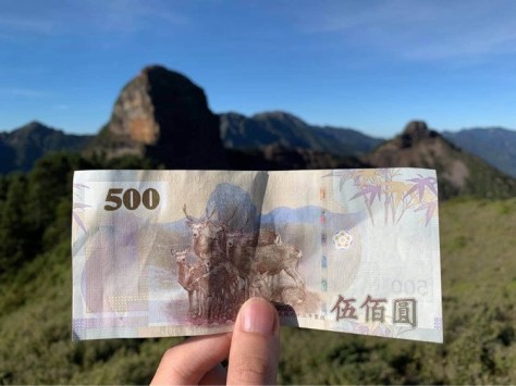
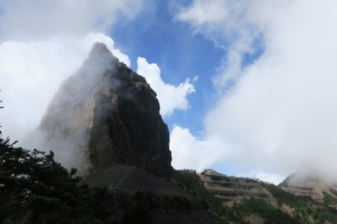
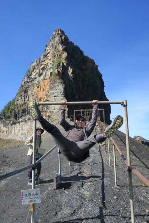
Dabajianshan 大霸尖山 (Dàbàjiān Shān, tr: ‘Big Chief Pointed Mountain’) at 3,492 meters, 11,456 feet, up in Hsinchu County, part of Shei-Pa National Park 雪霸國家公園, is variously described as ‘one of the most iconic high mountains of Taiwan’, a ‘fearsome triangular tower summit with vertical walls on all 3 sides about 150 meters high and 100 meters wide’, looking like a ‘large barrel of wine, cold and daunting’, and a ‘huge, towering block of rock that thrusts out into the sky’. The Japanese called it “The Wonder Summit of the Century” and they were the first to officially record an ascent to the summit in August 1927. Dabajianshan is so famous, so iconic in Taiwan that the mountain is even pictured on the NT$ 500 note ….
The indigenous people of the area, the Atayal and Saisiyat, believe Dabajianshan to be sacred, the birth place of their ancestors. For safety reasons it is now illegal to climb the rock face to the summit, but climbing as far as the base below that rock for a photo with the mountain sign is counted as having reached the top…

From Wikipedia: “The first half of Dabajian Mountain is a medium grade hill with about a 35° incline. The top half is an almost straight up rock face. The mountain’s steep grade and unique features were mainly formed by wind. The mountain is composed mainly of greywacke – a variety of sandstone generally characterized by its hardness, dark color, and poorly sorted angular grains of quartz, feldspar, and small rock fragments or lithic fragments set in a compact, clay-fine matrix. Greywackes are mostly grey, brown, yellow or black, dull-colored sandy rocks which may occur in thick or thin beds along with shales and limestones. They are abundant in Wales, the south of Scotland, the Longford Massif in Ireland and the Lake District National Park of England; they compose the majority of the main alps that make up the backbone of New Zealand.”
Taiwan has 286 peaks over 3,000 m in altitude, and of these, ‘The 100 Peaks of Taiwan’, known as the ‘Baiyue’ 百岳 are the famous ones that everyone hopes to climb. These 100 peaks were selected not necessarily just for altitude, but also for their uniqueness, danger, height, beauty and prominence.
There are 4 Baiyue on the Dabajianshan ridge:
1) Baiyue No. 28: Dabajianshan 大霸尖山 3,492 m / 11,456 ft
2) Baiyue No. 36: Xiaobajianshan 小霸尖山 3,418 m / 11,214 ft
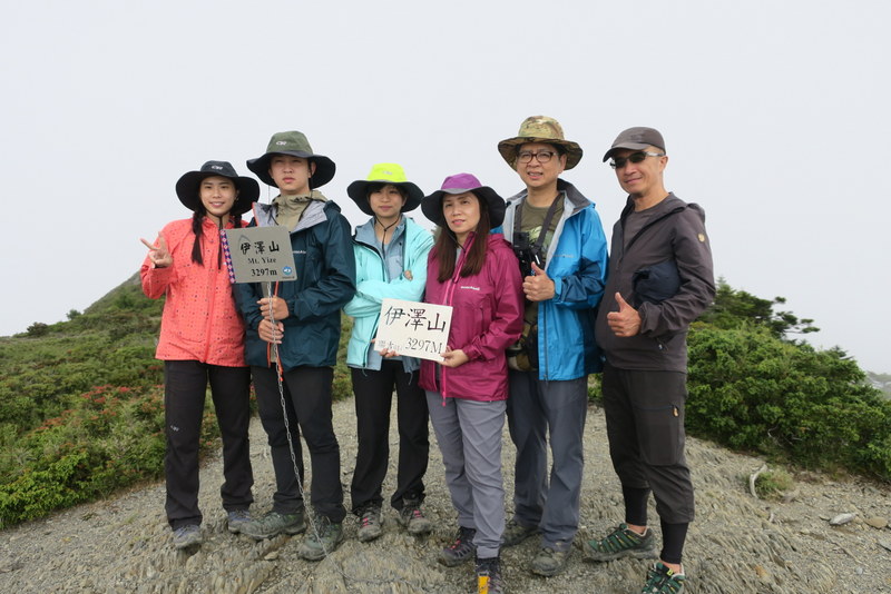
3) Baiyue No. 53: Yizeshan 伊澤山 3,297 m / 10,817 ft
4) Baiyue No. 86: Jialishan 加利山 3,112 m / 10,210 ft
Most hardened climbers do this trip to the Dabajianshan ridge in 3 days and 2 nights, but everyone says it’s hard work. We chose to do it by splitting day 1 into 2 days, and so we went for 4 days and 3 nights. The total length of the whole trail is about 60 km, and I read that the total elevation gain (ie how much we climbed) is 2,437 meters.

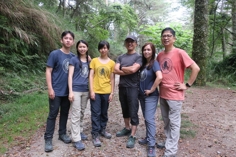
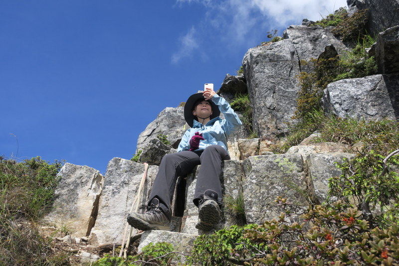
But first, let me rewind to a month or so ago when my good friend, Jasmine Yu very kindly invited me to join her 2020 family mountain trip; and I was delighted to say ‘YES!’ We went with our regular friendly mountain guide, Laisun, who led us on our first mountain trip way back in 2011, and except for last year when we couldn’t go at all, we’ve been going with him every year since. Back in 2011, Jasmine’s children were then aged 10 and 13, and over the years, we’ve also included grandma and many aunties and uncles, a few cousins and friends too. Possibly the most memorable trip was in July 2017 when we went to Yushan, Taiwan’s highest mountain (see that report here). This year, the older generation decided not to join us, but we had a great group of 8, Jasmine, her husband, their son and daughter, son’s girlfriend, a cousin, Laisun and me; that’s 4 older ones and 4 younger ones. Yes, it was fun! Jasmine and Laisun organized everything from applying for permits, the itinerary, accommodation, transport and advice on what to take. And what to wear too – we all had new T-shirts (of different colours but the same style) to wear on the summit!

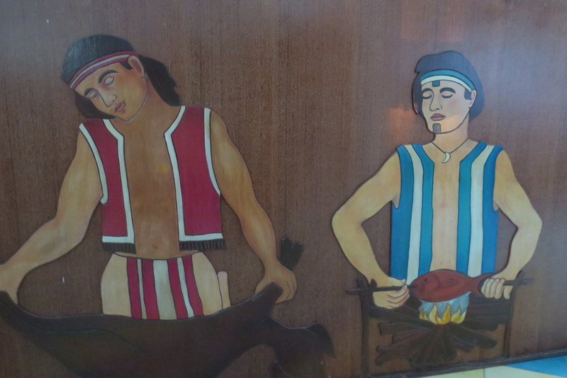
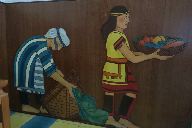
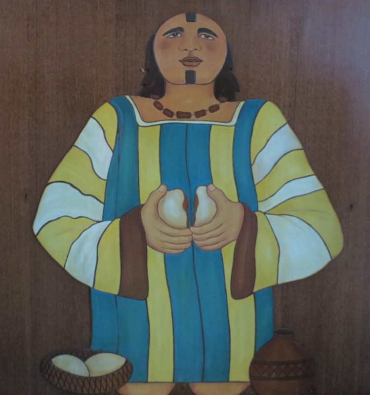
And thus it was that we met at 7:00 pm on Monday July 20 at Tamsui MRT Station and set off in a minibus heading to Hsinchu County and the remote Atayal Town of Chingchuan 清泉 where we spent the night (and enjoyed a really good breakfast too!) at the Chingchuan RC Church Hostel. The Jesuit priest there, Fr. Barry Martinsen 丁松青神父 from California is very well-known in Taiwan, having served here for over 50 years, along with his brother, who died just a few years ago. The church was open, and is decorated with Atayal pictures on wood around the church at ground level. Hidden behind the altar was an Atayal Jesus breaking bread ~ I especially liked that.


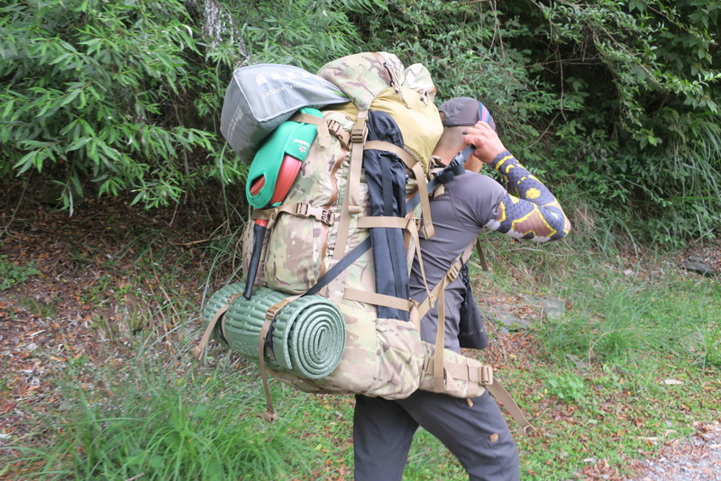
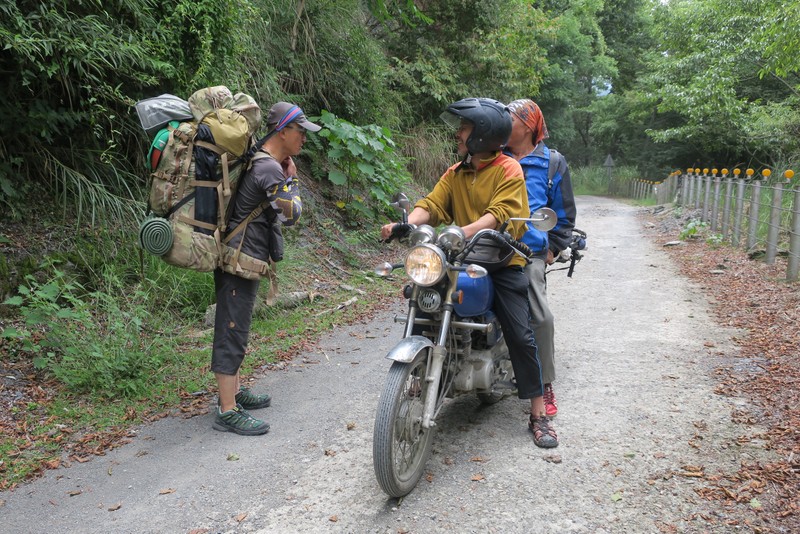
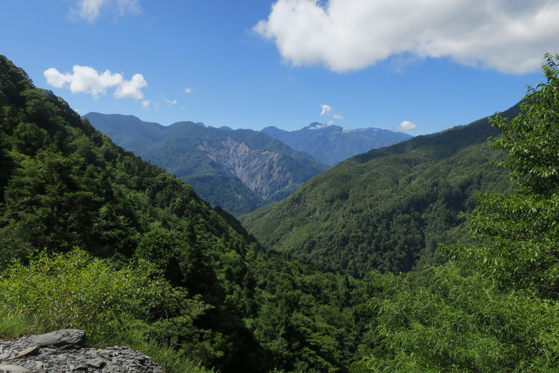
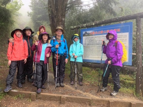
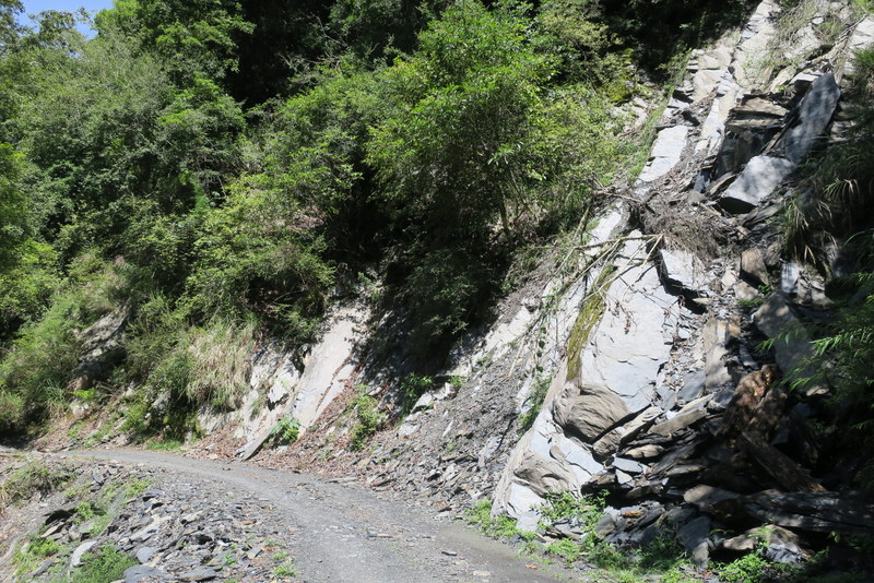
The next morning, Tuesday July 21, we left early and drove further up the mountain to the Guanwu Forest Park Trailhead to start our big expedition. Here begins the very long, and let’s be honest, painfully tedious Dalu Forest Road 大鹿林道 which winds its merry way, mostly downhill, for a seemingly never-ending 19 km to Madara Creek Trailhead 馬達拉溪登山口. It feels never-ending not because it’s unpleasant – in fact the scenery is stunning – but because such a road is not really suited to wearing climbing boots, and rucksacks are heavy, even though we’d all pared down to the bare minimum ~ still mine was probably 10 kg with sleeping bag, mat and water added. Laisun meanwhile was carrying over 30 kg, including all the food, pots and pans and gas canisters that we would need for 8 of us for 4 days!


Until Typhoon Morakot hit in August 2008, it was possible for private vehicles to drive up the Dalu Forest Road to the Madara Creek Trailhead, but after the typhoon washed away the road, the whole trail and therefore access to the mountain was closed off until 2015. When it opened up, it was forbidden for vehicles to use the road, and now everyone has to trek along the road on foot. We did see motorcycles on the track, they were ferrying supplies to the Madara Creek Trailhead, from where the extremely strong and capable young men of the Atayal tribe carry huge loads up the mountain to the 99 Mountain Hut.

We walked for 4-5 hours along the Dalu Forest Road, starting about 9:00 am, but we didn’t get all the way to the Madara Creek Trailhead on the first day, instead we decided to stop overnight at one of the huts on the road, the one at the 15 km mark. The huts are there to provide basic shelter, but other than that, there is no electricity, no toilets, water is from a nearby stream and they also cannot be booked overnight. Officially we were supposed to be camping, but, well, by early afternoon, we were tired, aching and the heavens were about to open with a massive thunderstorm, as happens every afternoon in the high mountains in summer. So we were very grateful that one of the huts was empty and we could rest our weary feet for the night.

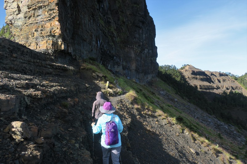
On Wednesday morning, July 22, well rested and refreshed (and with our sleeping bags stored in the hut ready to pick up on our return trip), we were up bright and early, starting out about 6:30 am for the remaining 4 km to the end of the Dalu Forest Road. There is a very steep short-cut downhill at the 17 km mark which cuts the final 2 km off the road walk, with ropes provided to help you down, though it’s much harder to balance with a rucksack, I can tell you!

Down at the Madara Creek Trailhead is another hut and also toilets with running water. It’s there that the path crosses the river on a red footbridge and the great ascent officially begins. Down below the bridge are the remains of the old suspension bridge that was washed away in a typhoon in 2012, which also took out part of the National Park office there which is still clinging on, though badly damaged and now unused.

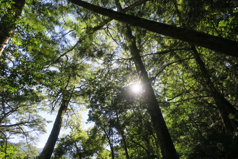
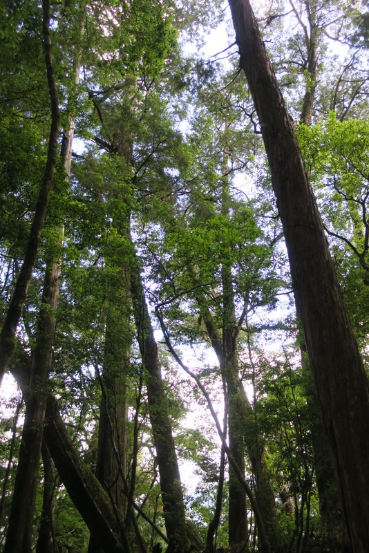
The path up is mostly steep, 4 km and 1,000 meters of ascent, all forested – including the famous hinoki cypress at higher altitudes.

We had a few rest stops of course….

The Atayal porters do the trip in an hour, we took 4 ½ hours, but even with rucksacks, hey, we got there by lunchtime! The ‘there’ we were heading for was the 99 Mountain Hut 九九山莊, named after it’s altitude of 2,699 meters above sea level.
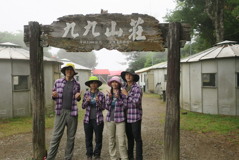

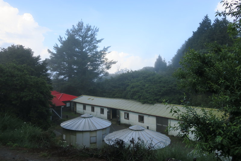

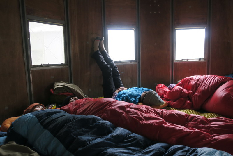
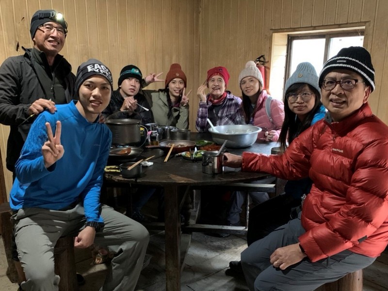
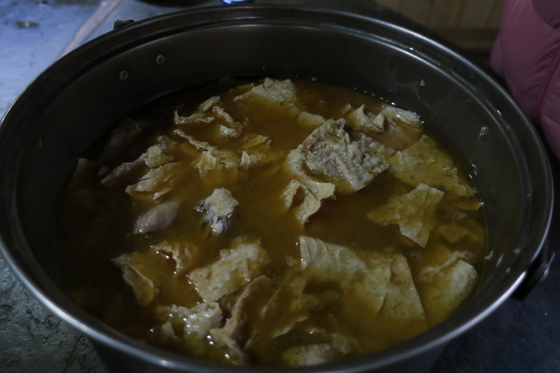
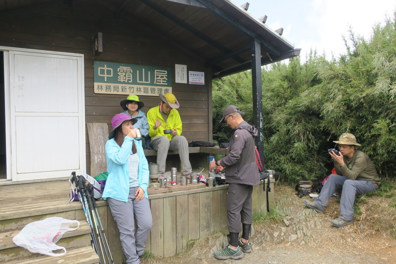
We were there for 2 nights, like nearly everyone else on the trail. There’s room for 300 people to stay overnight in large bunk dormitories or in smaller circular huts, which is where we stayed, and warm sleeping bags can be hired. Very cosy! The younger members of our group approved the row of toilets as being clean, with water streaming along under them washing away the waste, but each person has to take all their own rubbish, including used toilet paper, back down the mountain themselves. Electricity is available for overhead lighting for about an hour in the evening, but there are no plugs for recharging phones and although there is running water, it’s cold, and nobody takes a shower. In fact, do not expect a shower for the whole 4 days. As everyone is in this together, nobody gets too worried! It was 16°C during the day up there and about 10 at night, so it was OK, not too hot, not too cold. Meals can be booked at the 99 hut, or you can do it all yourself, and bring your own food and stoves. Laisun was in his element cooking up delicious meals with numerous dishes supplied for breakfast, lunch and dinner. Over the 4 days, we had steak, sausages, duck, chicken, rice, noodles, vegetables, soup, eggs, bread, and plenty more. And when he wasn’t actually cooking, he was boiling up water for us to drink during the day. We just had to supply our own snacks and drinks, like coffee – ah, such luxury!


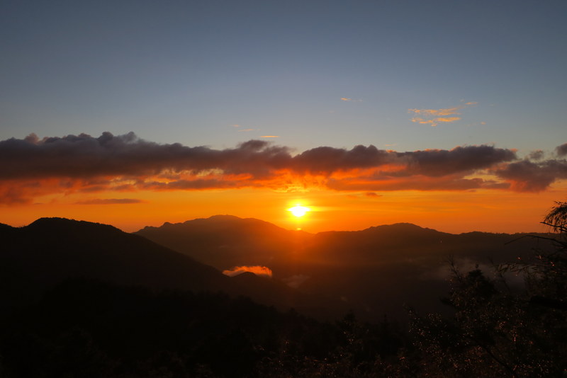
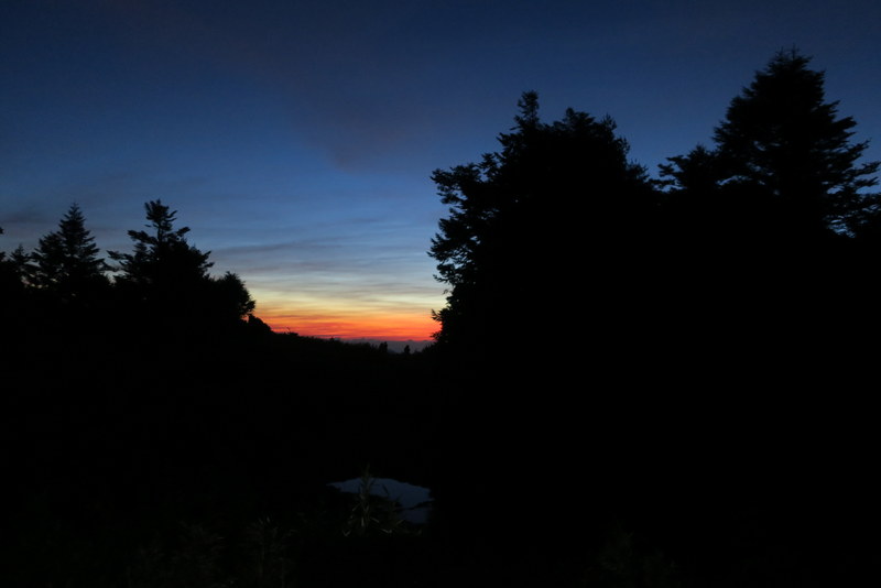
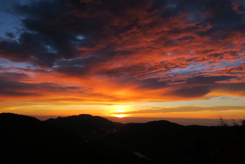
Every day, the main concern was not if, but when it would rain, because if possible we didn’t want to be out there in it! Every day by about 12 noon, the fog was already rolling in, and by about 2:00 pm, it started raining heavily, with thunder and lightning. This went on for an hour or two, then it all stopped, the fog cleared and both nights we were at the 99 hut, there was a magnificent sunset.

The sunset-viewing hill, just above the 99 hut, also happens to be the place where there is a phone signal, so it seems the whole camp went up there after dinner. I switched my phone off completely for the whole 4 days, but all those around me were busy calling family and friends, posting photos and live updates of the sunset. It really was spectacular watching the clouds part, then the sun’s reflection on the sea, and finally the sun descended from below the clouds and turned the sky all orange. A fitting way to end the day.


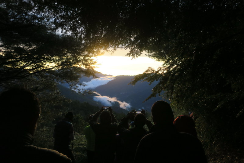
And that was the end of the day, because after dark at about 7:00 pm, there really wasn’t much else to do but sleep and get ready for a very early start the next day. The next day was the day we were finally going to see the mountains we had come for, and we would be spending the whole day on the top of the mountain ridge.

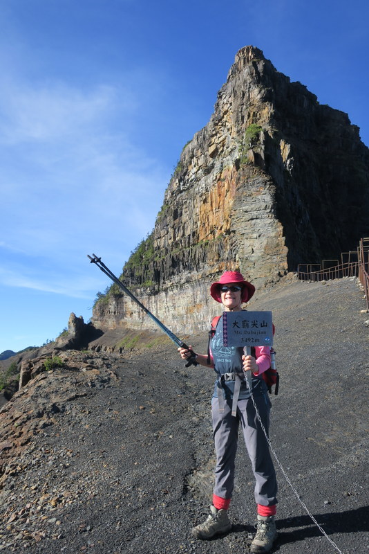
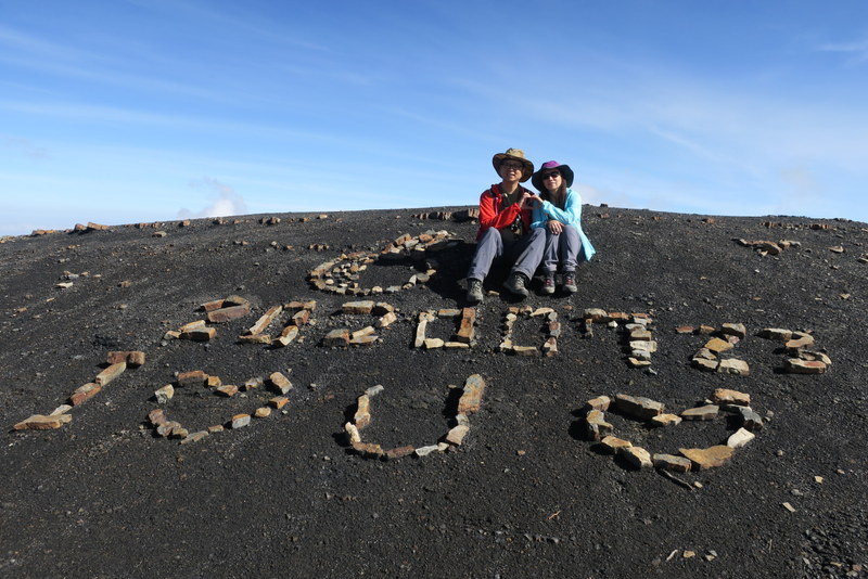
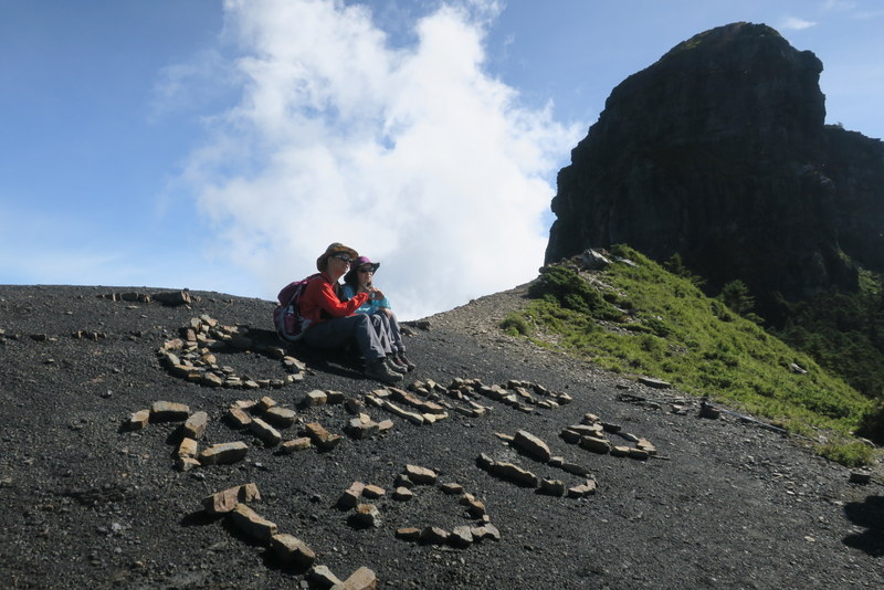
Thursday July 23 was THE day! It also happened to be the 27th wedding anniversary of Jasmine and her husband, and we even found them a place to celebrate, on the top of the mountain ridge where stones had been arranged to form the words “I love you” and the numbers 2020 07 23, that day’s date. But that would come later, first we had to get up very early, along with everyone else in the whole camp, and set off. ‘Very early’ means we arranged to have breakfast at 3:00 am in order to leave at 3:30 am – so that we could get to the top of the ridge and along to all 4 mountains and back before the rain came again. The pressure was on!
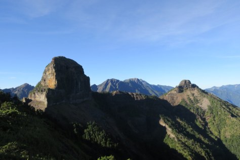
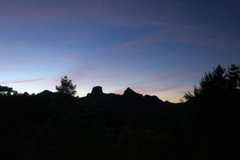
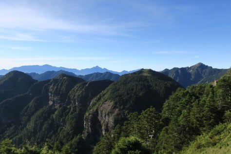
As we set off, the sky above was filled with stars, and the whole Milky Way seemed to be on display for us, plus a few planets thrown in for good measure! We were led by our headlights, and it was steep, but as our main luggage was now at the 99 hut, so we only needed day packs, and boy, are they so much lighter! As we went up, down on our left were the shimmering lights of Taiwan’s west coast cities, Hsinchu, and further south towards Taichung. At 4:45 am, we got our first real live sighting of Dabajianshan (the rounded one centre left) and Xiaobajianshan (the pointed one centre right). It was a big ‘wow’ moment!
Soon the sun came up, and by 7:00 am we had the most glorious views of the whole mountain ridge…


Another ‘wow’ moment was looking to the left of Dabajianshan to see Dongbajianshan東霸尖山 of which there seemed to be 5 separate rounded mountains, very dramatically lined up in a row…
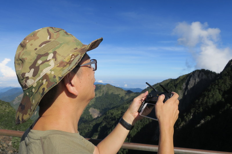
There was more to come, as we walked down through the forest path and up to the base of the rock face of Dabajianshan. That’s the place for the photos, our first Baiyue of the trip, whoopee! The rock face is just incredible, and from nearby, it’s possible to see that there must be a whole colony of swifts / swallows living there, as they’re all swirling around in the sky. Jasmine’s husband had brought along his mini-drone which he sent up to whirl around the mountain taking photos of us down below. The swifts were a bit uncertain about the drone, as was a butterfly, they came and circled around it checking out the strange object in their midst!
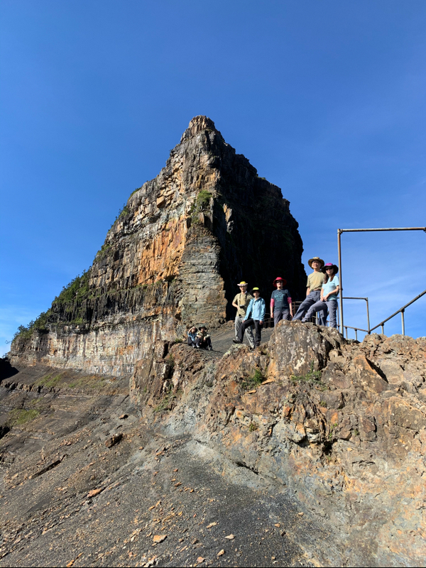

The metal frames there lead up to the edge of the rock face, from where we walked along, under the overhanging rock, past the rusted metal barriers that had once protected climbers in the past, now no longer in use. Soon we could see Taiwan’s east coast in the distance, with Turtle Island off the coast at Yilan, and further to the north, we could see Yangmingshan, the mountains above Taipei. We also passed the ‘I love you’ stone arrangements….


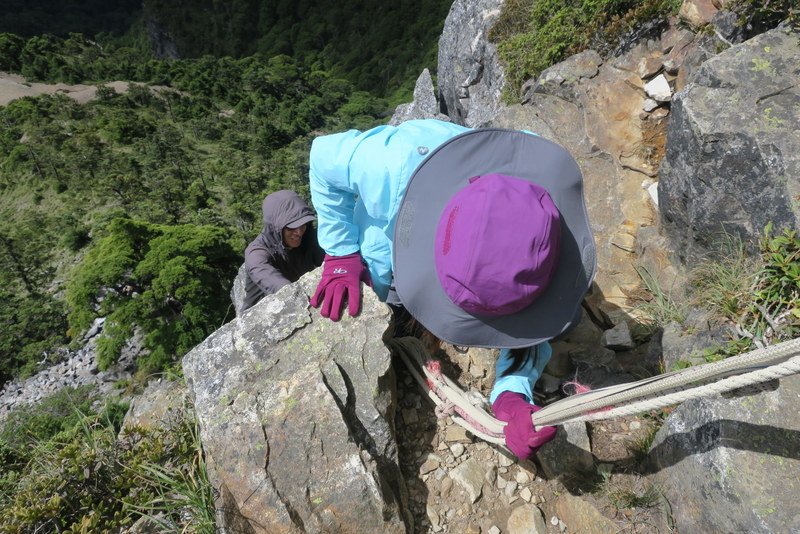
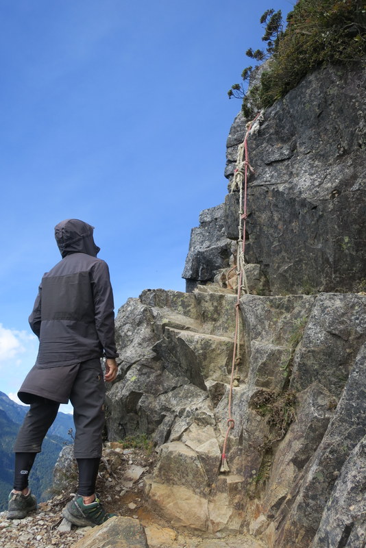
And so to Xiaobajianshan, tr: ‘Small Chief Pointed Mountain’. This is famous as being the most exhilarating part of the 4-day trip, as the top third of the summit has ropes and steep drops and ledges and all sorts of excitements that you need to get over to get to the top. We left our bags down on the ridge and it took us about 20 minutes to scale the rocks to the top. It was great! The summit was the highest point we actually climbed that day, 3,418 m.


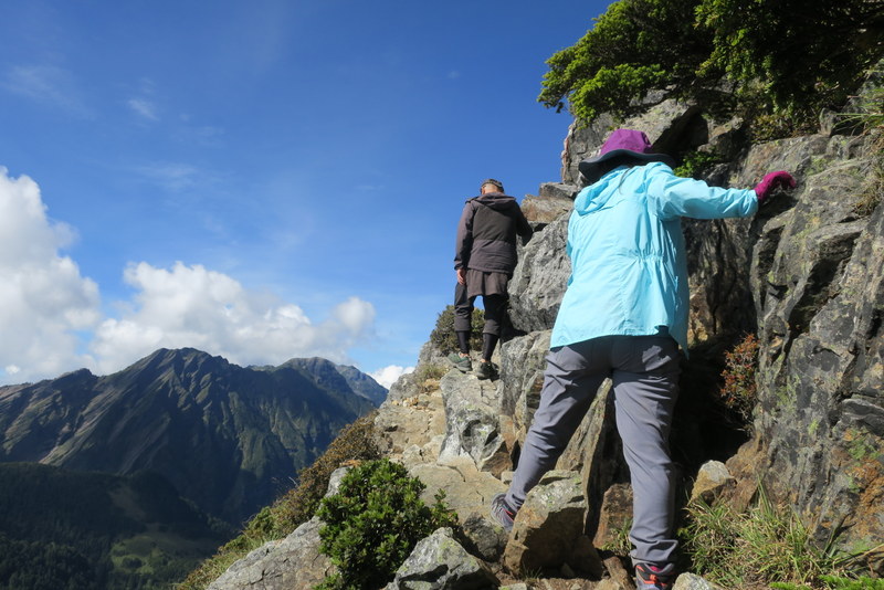


And so back down again, which was a bit scarier than going up, and even though it was only 9:00 am, already the clouds were gathering, fog was starting to roll in and we had to get a move on.


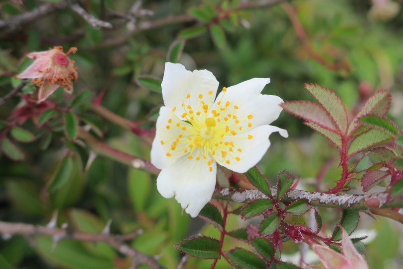
Walking along back the way we came, we saw some beautiful Alpine flowers…


But by the time we turned around to get our last look at Dabajianshan and Xiaobajianshan, they were already disappearing into the fog!
This is our 3-minute drone footage on YouTube of that section of the trip – the music really adds to the atmosphere – do look at it, it’s great. Spot us walking along below the rock-face on the way back looking like little ants!
We had to go back on the same route as we came, but first we headed to Zhongba Hut, where we had left our cooking stuff on the way up in the morning, and where Laisun cooked up some noodles for lunch. Yum yum! On our way up in the morning, we had passed signposts to the 2 remaining Baiyue mountains, leaving them for the return trip in the afternoon. By 12 noon, we were up on the summit of Yizeshan 伊澤山 3,297 m, which is only about a short detour from the main path. On a clear day, the view would be great, but it was already foggy, apparently it’s quite normal for this time of year.

We had one more mountain to go, and the skies were turning darker and darker. The detour to Jialishan 加利山 3,112 m would take us about 40 minutes round-trip, but despite the threat of rain, still we just had to do it!

In the event, 6 of us took the detour, and though we got there fine at 2:00 pm, it started to rain the moment we left the summit and we had to move quite quickly. Back on the main path it was already raining hard, and even though we all hurried to get dressed up in our rain-gear, it was already a bit late, and well, we were very wet! But then, what is a mountain trip without a bit of rain? And thunder? And a lot of fog? We headed back down to the 99 hut in the rain, with distant thunder, and got safely back there about 3:30 pm, exactly 12 hours after starting out that morning…
And amazingly by the evening, the skies had cleared and we had a glorious sunset with hardly any fog to be seen! The whole sky was orange and pink. It was really such a beautiful way to end such an amazing day – and such a wonderful trip.

Friday July 24 was our final day, the day of the great descent from the 99 hut, all the way back to the Dalu Forest Road and so to the trail head and back home. We started very early, breakfast at 2:30 am and by 3:30 am we were all packed up and with our headlights on, ready to descend to the creek. We met 9 porters coming up in the dark with their massive loads, also groups starting their ascent, and later on, on the uphill forest road, we met lots of people heading along and up to the 99 hut, and many asked us about the rain and what time we had started out. The 4 younger people in our group all sped along, as did Laisun, now relieved of much of his heavy load – well, the food anyway. We were the group at the back, stopping at most of the rest stops and counting every 0.1 km as we passed each of the route markers! Just grateful we had left so early, so it wasn’t too hot, and it didn’t rain. We got back to the minibus at the Dalu Forest Road Trailhead at about 12 noon, relived to be back safe and sound, and so happy!


A very big thank you to Laisun for his calm leadership, flexible pace-setting, delicious cooking and being so willing to carry everything; he was heading back out to the high mountains later on Friday with another group, actually some of Jasmine’s former colleagues, who were going to climb Nanhu Big Mountain. He commented that due to the current Covid-19 pandemic, his mountain-climbing business had been badly affected earlier in the year, but now that restrictions have eased, people are once again venturing forth up the mountains – and as nobody wants to travel overseas for the foreseeable future, so they are using their holidays to climb Taiwan’s high mountains. This is Laisun in action….!
Another very big thank you to Jasmine for being so willing to include me in their family group, even to supplying the group T-shirts – and for keeping me up to date on how many Baiyue I have climbed since 2011; it’s now 22 in total, and all with Jasmine and her family! This was not the first time we had applied for permits for this trip, the other times had been unsuccessful; so thanks to Jasmine for her persistence in not giving up! I also really appreciated Jasmine’s husband for being so enthusiastic about taking photos and videos on his camera, GoPro and drone, and grateful to the younger generation for their willingness to help out, washing dishes, taking photos, fetching water, and generally cooperating and fitting in with the timetable – after all, getting up at 2:30 am for breakfast is really not everyone’s idea of fun 😮😃 – just don’t mention to them about the mouse at the 99 hut that ate its way through their Oreo biscuits! This is the group playing cards one evening…

Most of all, thanks be to God for his protection and safe-keeping. This is the typhoon season, so we were a bit worried; we had also heard from friends that they had climbed all the way up to Dabajianshan, only to see it shrouded in thick fog, and then it had rained all the time on the descent. In fact, every morning we had really good weather, no typhoon was forecast, and where was the wind? There was none! This time, everything went so well, and we are grateful for God’s grace and mercy throughout the trip. Yes, a big thumbs up, it was a great trip!

There is really not much in English on the internet about hiking Dabajianshan, but for further information, the following 2 blog posts are recommended:
How to hike Mount Dabajian-Part 1 – 大霸尖山 / Part 2 October 2019
Hiking in Taiwan: Dabajianshan (大霸尖山) 4-Day Solo Hike August 2017

Scenic but terrifying. Well done that girl with the fear of heights! x
Thanks Sarah!
Yes, just right
Wow! Thanks, Catherine. Your articles in which you post where you are inspires me to go to these places. I can, because I am in Taiwan.